
OS grid reference TQ595855 Sovereign state United Kingdom Dialling code 1708 | Postcode district RM14 Local time Sunday 8:59 AM | |
 | ||
Weather 13°C, Wind W at 35 km/h, 72% Humidity | ||
North Ockendon is the easternmost and most outlying settlement of Greater London, England and part of the London Borough of Havering. It is located 18.3 miles (29.5 km) east northeast of Charing Cross and consists of a dispersed settlement within the Metropolitan Green Belt. It was historically an ancient parish in the county of Essex, that was abolished for civil purposes in 1936. North Ockendon is the only area in London located outside of the M25 London Orbital Motorway. North Ockendon is located on the border with Essex. The area to the south is South Ockendon.
Contents
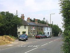
Map of North Ockendon, Upminster, UK
History
North Ockendon parish had an ancient shape that was elongated east-west, thus contrasting with a series of perpendicular parishes to its north and west. With the adjoining parishes this formed a large estate that is at least middle-Saxon or, perhaps, even Roman or Bronze age. From 1894 until it was abolished in 1936, North Ockendon formed a parish in the Orsett Rural District of Essex. The majority of its former area was used to enlarge the Cranham parish of Hornchurch Urban District and the remainder of the former parish, around 383 acres (1.55 km2), was used to form part of Thurrock Urban District in 1936.
In 1965 Hornchurch Urban District was abolished and its former area, including North Ockendon, was transferred to Greater London and used to form the present-day London Borough of Havering. North Ockendon and Great Warley were to the east of the M25 motorway when it was constructed. In 1992 it was proposed that the part of Greater London to the east of the M25 should be transferred to Essex, with the Great Warley section north of the railway transferred to Brentwood and the North Ockendon section to the south transferred to Thurrock. The transfer of North Ockendon from London to Essex was strongly opposed. Following the review the Great Warley section was transferred to Essex, but the North Ockendon part was not, leaving it the only part of Greater London to be outside the M25 motorway.
North Ockendon is the location of Stubbers, a former stately home which was demolished in 1955 and the grounds of which is now used as an activity centre.
Elizabeth Kucinich, wife of the U.S. congressman and presidential candidate, was born in North Ockendon in 1977.
Demography
North Ockendon lies within the Upminster ward. The 2011 census showed that the population was 96% white (92% British, 2% Other, 2% Irish). Indian, Chinese and Black African were 1% each.
Geography
To the east is a small area of fenland, which extends into Bulphan and the rest is clays and Thames alluvials. The land is very low lying. The field boundaries are wholly rectilinear. To the far north, beyond the London, Tilbury and Southend Railway, it borders the villages of Great Warley, Little Warley and Childerditch in the borough of Brentwood, the settlements of West Horndon and Bulphan to the east and South Ockendon to the south which is in the borough and unitary authority of Thurrock. It is the only significant settlement in Greater London which lies outside the M25 motorway.
The parish church of St Mary Magdelene has a probably re-used Norman nave door on the south side of the nave. Its tower was used in the first accurate measurement of the speed of sound, by the Reverend William Derham, Rector of Upminster. Gunshots were fired from the tower and the flash thereof was observed by telescope from the tower of the church of St Laurence, Upminster; then the time was recorded until the sound arrived, from which, with an accurate distance measurement, the speed could be calculated.
Transport
The nearest railway stations are at Ockendon and Upminster. London bus routes 347 and 370 directly link the area with Upminster and Romford, as well as Lakeside Shopping Centre (370 only), and Essex routes 269 and X81 link the area with Brentwood (both) as well as Grays (269) and Lakeside Shopping Centre (X81).