
 | ||
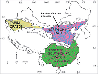
The North China Craton is one of the smaller continental cratons of Earth. It covers a total area of around 1.7 million square kilometres (655,500 square miles) in northeastern China, northern Korea and the southern part of Mongolia, and has a shape quite akin to a funnel, with a long east–west axis in the western part and two shorter perpendicular axes in the eastern half.
Contents
Geological history
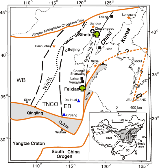
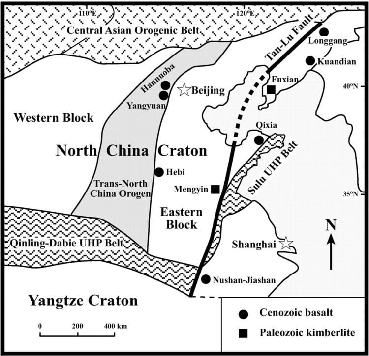
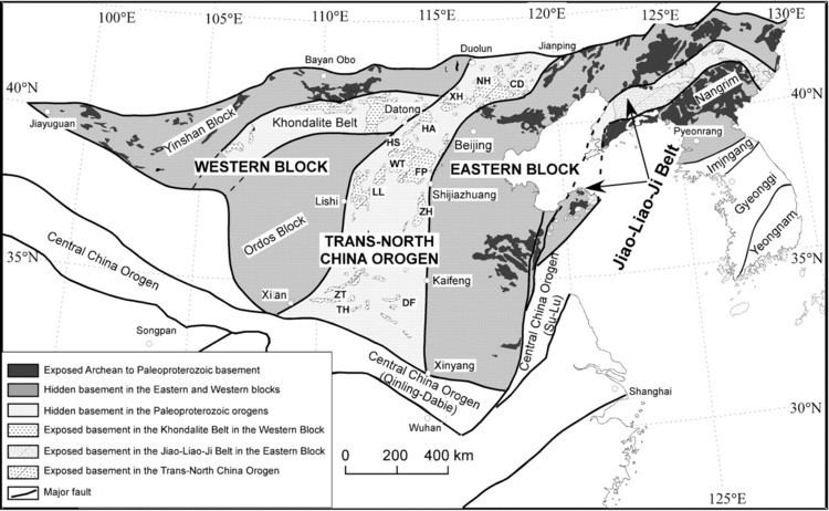
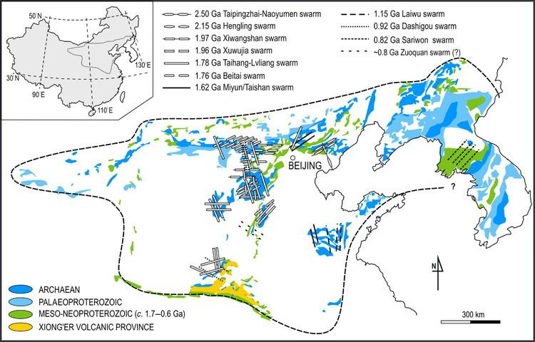
The North China Craton is composed of several major blocks that have been heavily tilted and folded over time as a result of collisions with other continental land masses. The main blocks include the Eastern Block, the Western Block and the Central Orogenic Belt. The Central Orogenic Belt runs from western Liaoning through Beijing municipality to western Henan and contains chiefly igneous rocks of Paleoproterozoic age. The Western Block extends west from this region through Shanxi, Shaanxi, Inner Mongolia and northern Gansu. This block is the oldest and most stable part of the Craton and contains some of the oldest and mineralogically most valuable rocks in Asia, especially in Inner Mongolia where huge deposits of coal and iron ore are found.
The Eastern Block is unusual for a craton in that it is affected severely by crustal thinning that began in the Mesozoic and is known to have reduced the thickness of the crust from 200 kilometres to as little as 80 kilometres. In the Changbai Mountains and Shandong there has been extensive volcanism in the Tertiary. The crustal thinning of the Eastern Block is believed to be due to high heat flow within the plates (especially the Pacific Plate) surrounding the North China Craton.
Prior to the Triassic, the North China Craton was an independent continent surrounded by oceans. For most of the Paleozoic, it was located near the north pole, often being the northernmost land in the world until it collided with Siberia to comprise the last stage in the formation of Pangaea during the Triassic.
Geography
The Eastern Block of the North China Craton consists mainly of the densely settled and very fertile North China Plain, one of the most densely populated rural regions in the world. It is drained chiefly by the lower reaches of the Yellow River and Hai He, both of which are among the siltiest rivers in the world and provide enormous amounts of essential plant nutrients when they flood during the summer. The climate of the North China Plain is humid but continental, with most precipitation occurring between June and September, though significant falls in winter do occur in the southern part of the region. Annual rainfall in the southern part of the North China Plain averages around 1,150 millimetres (45 inches), but declines to around 600 millimetres (24 inches) in the north. Temperatures vary widely, but summer is always hot with the average July maximum usually around 31 °C (88 °F) with high humidity. January temperatures range from about 3 °C (37 °F) in the extreme south to −10 °C (14 °F) north of Beijing.
In complete contrast, the Western Block is a dry, elevated plateau averaging over 1,000 metres (3,300 ft) in elevation and having a dry and extremely continental climate. Annual rainfall is typically only around 300–400 millimetres (12–16 inches) and winter temperatures are often as low as −20 °C (−4 °F), whereas summers can be blistering. Because of the huge accumulations of loess from Himalayan glaciation, the soils are very fertile when irrigated, but water shortages remain a serious problem for farmers. Sheep are grazed in large numbers away from the rivers.
The Central Orogenic Belt is mainly rocky mountains up to 2,360 metres (7,740 ft) in elevation. Because of the extreme cold and erosion risk, most of this mountainous land is not cultivated and in places extensive forests still remain.