
Existed: 1939 – present Length 98.7 km | Constructed 1939 | |
 | ||
Counties | ||
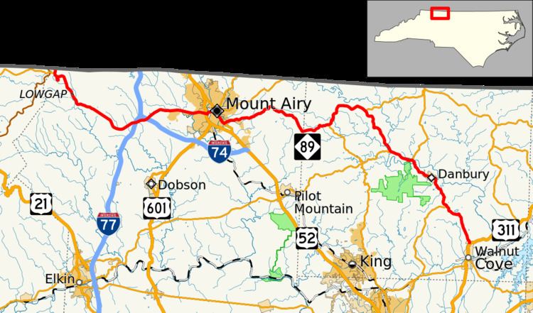
North Carolina Highway 89 (NC 89) is a 61-mile-long (98 km) east–west state highway route that mainly runs through small communities and towns in northern North Carolina including Mount Airy and Danbury. The entire route spans only two counties in the state: Surry and Stokes. It can be accessed from the Blue Ridge Parkway via Virginia's State Route 89 (the highway that continues from NC 89's western terminus) or an interchange with NC 18 which intersects NC 89 near its western terminus. Interstates 77 and 74 both intersect NC 89 west of Mount Airy.
Contents
Map of NC-89, North Carolina, USA
Route description
The route begins at US 311 in Walnut Cove and travels westward to team with NC 8 through Danbury; the routes split shortly after leaving the town. Continuing west, NC 89 enters Mount Airy at Bannertown where the route shares Business US 52 into the heart of the city. The route then runs independently out of city as Pine Street into Toast where it intersects with Bypass US 52. Exiting Toast, NC 89 meets I-74 and then one mile (1.6 km) further, I-77 (exit 100). The route continues past Lowgap and the eastern terminus of NC 18 before ending at the Virginia/North Carolina border in Surry County, North Carolina, where Virginia's SR 89 begins.