
 | ||
The Niagara River Greenway Plan is a comprehensive plan focusing on the development of a greenway of interconnected parks, river access points and waterfront trails along the right bank of the Niagara River from Lake Ontario to Lake Erie. The plan was drawn up by The Niagara River Greenway Commission, first established in 2004 by then New York state Governor George Pataki.
Contents
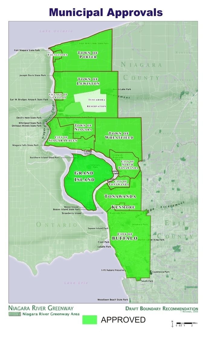
Location of The Greenway
The Greenway is defined by Municipal boundaries. Currently 13 Towns, Villages, Cities and Municipalities are located within the Greenway. Upon completion the Greenway will encompass approximately 35 miles (north to south) of greenspace.
Included Municipalities
References
Niagara River Greenway Plan Wikipedia(Text) CC BY-SA