
Existed: 1978 – present Counties: Clark Constructed 1978 | East end: SR 612 in Las Vegas Length 49.9 km | |
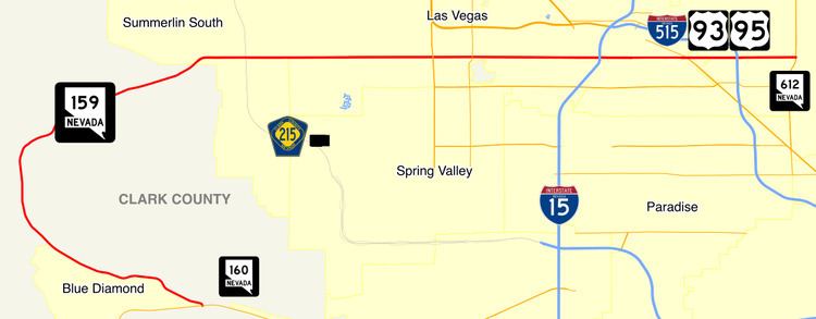 | ||
West end: SR 160 near Blue Diamond | ||
State Route 159 (SR 159) is a 31.007-mile (49.901 km) east–west highway in southern Nevada, providing access to Red Rock Canyon and serving as a thoroughfare in the Las Vegas metropolitan area. A portion of the west end of the route is designated a Nevada Scenic Byway.
Contents
Map of NV-159, Las Vegas, NV, USA
Route description
State Route 159 has two distinct segments. The first segment is a rural two-lane highway that begins at its junction with SR 160. The highway proceeds northwest through the town of Blue Diamond towards Spring Mountain Ranch State Park. From there, the highway curves northeast around Red Rock Canyon to the Las Vegas city limits west of the Las Vegas Beltway. This segment of SR 159 is known on maps and signs as Blue Diamond Road (assuming the name from SR 160), but is also referred to as Red Rock Canyon Road.
As SR 159 enters the city of Las Vegas, it transitions into Charleston Boulevard, a major east–west section line arterial bisecting the Las Vegas Valley. The highway crosses the Las Vegas Beltway and runs through the planned community of Summerlin. SR 159 continues east to intersect Interstate 15 and then passes south of Downtown Las Vegas. From there, the highway ventures further east to intersect Interstate 515 and U.S. Routes 93 and 95 before reaching its terminus at Nellis Boulevard (SR 612). (Charleston Boulevard itself ends about three miles (5 km) east of Nellis Boulevard near Frenchman Mountain.)
History
A portion of Charleston Boulevard was previously designated U.S. Route 95 Alternate to bypass downtown Las Vegas. The designation began at Fremont Street (SR 582) and continued west to Rancho Drive (SR 599), where it curved north to reconnect to US 95. The alternate route was discontinued in 1982.
Approximately 8.8 miles (14.2 km) of SR 159 in Red Rock Canyon was designated a Nevada Scenic Byway on June 30, 1995.
Major intersections
The entire route is in Clark County.
Public Transport
Current RTC route 206 functions on this road.