
Elevation 1,236 m | Prominence 601 m | |
 | ||
Topo map USGS Frenchman Mountain, NV Similar Sunrise Mountain, Gass Peak, Potosi Mountain, Bridge Mountain, Mummy Mountain | ||
Frenchman mountain summit lv nevada
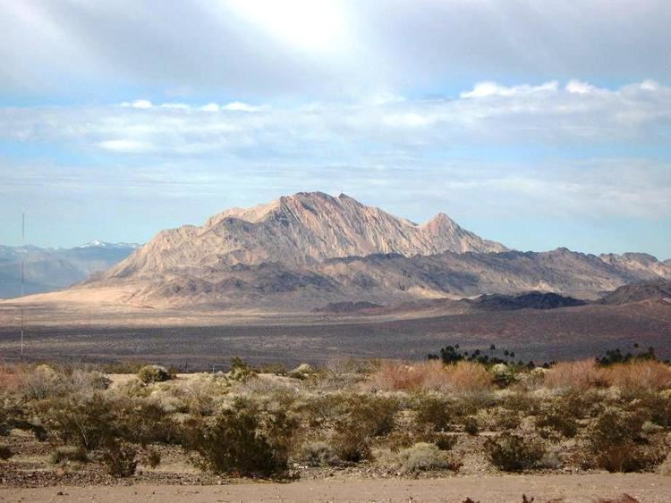
Frenchman Mountain is located east of Las Vegas in the U.S. state of Nevada. Made up of rocks similar to those found on the bottom of the Grand Canyon, Frenchman Mountain formed when faulting elevated and tilted the rocks followed by erosion, giving it its sharp triangular profile. It is the site of the Great Unconformity with the tilted Paleozoic strata underlain by Paleoproterozoic Vishnu Schist, which is some of the oldest rock on the North American continent, having been created about two billion years ago.
Contents
Map of Frenchman Mountain, Sunrise Manor, NV 89156, USA
The peak lies on a north to north-northeast trending ridge about 2000 feet above the nearby valleys. Sunrise Mountain lies 3.6 miles (5.8 km) to the northeast adjacent to Nellis Air Force Base. The north end of the McCullough Range about 12 miles (19 km) to the south has a parallel trend. The River Mountains lie to the southeast. State Route 147 crosses its northern slope. A geologically rich area called Rainbow Gardens is located to its southeast, as is an igneous laccolith, Lava Butte. The Frenchman Mountain Fault poses a significant earthquake danger to the Clark County, Nevada (Las Vegas) region.
It is commonly, and mistakenly, referred to as Sunrise Mountain, the name of a smaller peak to the north of Frenchman Mountain. The area from Cheyenne Avenue and Boulder Highway and Lamb Boulevard is commonly known as Sunrise Manor Township CDP.