
Founded July 1, 1909 Time zone Pacific: UTC-8/-7 Population 2.028 million (2013) Unemployment rate 7.1% (Apr 2015) | Congressional districts 1st, 3rd, 4th Area 20,878 km² | |
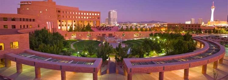 | ||
Website www.clarkcountynv.gov/Pages/default.aspx Destinations Colleges and Universities University of Nevada - Las Vegas, College of Southern Nevada, Nevada State College, Touro University Nevada, The Art Institute of Las Vegas | ||
Las vegas clark county nevada united states north america
Clark County is a county located in the U.S. state of Nevada. As of the 2010 census, the population was 1,951,269, with an estimated population of 2,000,759 in 2012. It is by far the most populous county in Nevada, accounting more than two-thirds of its residents. Las Vegas, Nevada's most populous city, has been the county seat since the county was established.
Contents
- Las vegas clark county nevada united states north america
- Map of Clark County NV USA
- Mud springs rd clark county nevada
- Geography
- Adjacent counties
- National protected areas
- 2000 census
- 2010 census
- Law and government
- Regional agencies
- State government
- Education
- Parks and recreation
- Gaming areas
- Environmental factors
- Earthquake hazards
- Economy
- Tourism
- Largest employers
- Communities
- Cities
- Air Force Bases
- Notable government buildings
- References
Map of Clark County, NV, USA
The county was formed by the Nevada Legislature by splitting off a portion of Lincoln County on February 5, 1909, and came into existence on July 1, 1909. The Las Vegas Valley, a 600 sq mi (1,600 km2) basin, includes Las Vegas as well as the other primary population center, the unincorporated community of Paradise.
Much of the county was originally part of Pah-Ute County, Arizona Territory before Nevada became a state. The county was named for William Andrews Clark, a Montana copper magnate and U.S. Senator. Clark was largely responsible for the construction of the Los Angeles and Salt Lake Railroad through the area, a factor heavily contributing to the region's early development.
Clark County is today known as a major tourist destination, with 150,000 hotel rooms. The Las Vegas Strip, home to most of the hotel-casinos known to many around the world, is located not within the City of Las Vegas city limits, but in unincorporated Paradise. It is, however, located in the Las Vegas Valley.
Clark County is coextensive with the Las Vegas–Paradise, NV Metropolitan Statistical Area, a metropolitan statistical area designated by the Office of Management and Budget and used by the United States Census Bureau and other agencies for statistical purposes.
Mud springs rd clark county nevada
Geography
According to the U.S. Census Bureau, the county has a total area of 8,061 square miles (20,880 km2), of which 7,891 square miles (20,440 km2) is land and 169 square miles (440 km2) (2.1%) is water.
The Colorado River forms the county's southeastern boundary, with Hoover Dam forming Lake Mead along much of its length. The lowest point in the state of Nevada is located on the Colorado River just south of Laughlin in Clark County, where it flows out of Nevada into California and Arizona. Las Vegas is a valley. By definition, Greater Las Vegas is a tectonic valley, surrounded by four mountain ranges, with nearby Mount Charleston being the highest elevation at 11,918 ft (3,633 m), located to the northwest. Other than the forests on Mount Charleston, the geography in Clark County is a desert. Creosote bushes are the main native vegetation, and the mountains are mostly rocky with little vegetation.
Adjacent counties
National protected areas
There are 20 official wilderness areas in Clark County that are part of the National Wilderness Preservation System. Many of these are located in, or partially located in, one of the preceding protected areas, as indicated below. Many are separate entities that are managed by the Bureau of Land Management (BLM):
2000 census
In 2000 there were 512,253 households out of which 31.70% had children under the age of 18 living with them, 48.70% were married couples living together, 11.80% had a female householder with no husband present, and 33.70% were non-families. 24.50% of all households were made up of individuals and 6.70% had someone living alone who was 65 years of age or older. The average household size was 2.65 and the average family size was 3.17.
In the county, the population was spread out with 25.60% under the age of 18, 9.20% from 18 to 24, 32.20% from 25 to 44, 22.30% from 45 to 64, and 10.70% who were 65 years of age or older. The median age was 34 years. For every 100 females there were 103.50 males. For every 100 females age 18 and over, there were 102.80 males.
The median income for a household in the county was $53,536, and the median income for a family was $59,485. Males had a median income of $35,243 versus $27,077 for females. The per capita income for the county was $21,785. About 7.90% of families and 10.80% of the population were below the poverty line, including 14.10% of those under age 18 and 7.30% of those age 65 or over.
The United States Census Bureau 2009 estimates place the population for the Las Vegas Metropolitan Statistical Area at 1,902,834 people, and the region is one of the fastest growing in the United States. Large numbers of new residents in the state originate from California.
2010 census
As of the 2010 United States Census, there were 1,951,269 people, 715,365 households, and 467,916 families residing in the county. The population density was 247.3 inhabitants per square mile (95.5/km2). There were 840,343 housing units at an average density of 106.5 per square mile (41.1/km2). The racial makeup of the county was 60.9% white, 10.5% black or African American, 8.7% Asian, 0.7% Pacific islander, 0.7% American Indian, 13.5% from other races, and 5.1% from two or more races. Those of Hispanic or Latino origin made up 29.1% of the population. In terms of ancestry, 11.7% were German, 9.1% were Irish, 7.6% were English, 6.3% were Italian, and 2.7% were American.
Of the 715,365 households, 34.9% had children under the age of 18 living with them, 45.0% were married couples living together, 13.5% had a female householder with no husband present, 34.6% were non-families, and 25.3% of all households were made up of individuals. The average household size was 2.70 and the average family size was 3.26. The median age was 35.5 years.
The median income for a household in the county was $56,258 and the median income for a family was $63,888. Males had a median income of $43,693 versus $35,324 for females. The per capita income for the county was $27,422. About 8.7% of families and 11.7% of the population were below the poverty line, including 16.9% of those under age 18 and 7.6% of those age 65 or over.
Law and government
Clark County Government is run by the Clark County Commission which consists of seven members who are elected to serve staggered four-year terms in biannual partisan elections.
After each election, the members elect a chairman who runs the commission meetings. Actual day-to-day operations are handled by the county manager who is hired by the commission. Its unincorporated towns also have appointed boards that provide advice to the commission.
The county operates out of the Clark County Government Center located in the City of Las Vegas. The building is unusual in shape, and includes an outdoor amphitheater where concerts and other events are held.
The Las Vegas Metropolitan Police Department provides most law enforcement services in the county, including operation of the county's central jail, the Clark County Detention Center (CCDC). The present department was created in 1973 when the Clark County Sheriff's Department merged with the Las Vegas Police Department.
Other entities that have their own police forces include University of Nevada, Las Vegas, the Clark County School District, and cities such as Henderson, Mesquite, Boulder City and North Las Vegas. The Clark County Park Police is responsible for all of the parks operated by the county and some selected special venues, such as the Clark County Amphitheater, Clark County Archery Range, and the Desert Rose Golf Course.
The Regional Justice Center replaced the Clark County Courthouse in 2005, and is located about 3 blocks from downtown Fremont Street, at 200 Lewis Avenue.
Regional agencies
The Clark County Regional Flood Control District (CCRFCD) was created in 1985 by the Nevada Legislature allowing Clark County to provide broad solutions to flooding problems.
The Regional Transportation Commission of Southern Nevada operates the RTC Transit system, and does planning for most major roadways.
The Southern Nevada Water Authority is a multi-agency group that manages the water distribution for the Las Vegas Valley.
The Las Vegas Wash Coordination Committee manages and protects the Las Vegas Wash.
Since 1999 the group has added more the 15,000 plants to stabilize the wash's banks and restore and expand the wetlands surrounding the wash. As part of the effort to restore the wash to a more natural state, they have also removed more than 500,000 pounds (230,000 kg) of trash.
State government
The Grant Sawyer State Office Building, which houses many branches of state government, is located within the City of Las Vegas.
The Nevada Department of Corrections operates three prisons within Clark County. High Desert State Prison, a medium-maximum prison, and the Southern Desert Correctional Center, a medium security prison, are both near Indian Springs, Nevada.
The Florence McClure Women's Correctional Center is located in North Las Vegas. The facility, originally the Southern Nevada Women's Correctional Facility opened September 1, 1997. It was built and operated by Corrections Corporation of America. On October 1, 2004, the Department of Corrections took direct control of the facility. It houses the female death row.
Education
The Clark County School District serves all of Clark County with 228 elementary schools, 59 middle schools, and 54 high schools being the fifth largest in the country. Current enrollment of students as of 2013 was 312,892.
Colleges serving the area are University of Nevada, Las Vegas (UNLV), College of Southern Nevada, and Nevada State College.
Parks and recreation
Gaming areas
The State of Nevada divides the state into several gaming districts. The reporting districts affecting Clark County are:
Environmental factors
Clark County contains a diverse desert flora and fauna, including higher elevation mountain areas, the desert floor and the Colorado River/Lake Mead ecosystems. Variations in diurnal temperature as well as seasonal swings in temperature create demanding adaptation elements on the species of this county. Additional pressure has been placed on species survival by the rapid human population expansion, especially since 1970.
Correspondingly air quality levels prior to the 1960s were in a favorable range, but the proliferation of automobiles with the human population expansion created circumstances where some Federal Air Quality Standards began to be violated in the 1980s.
To plan for the wave of development forecast by 1980, Clark County embarked on a regional Environmental Impact Assessment funded by a Federal Section 208 program, with Sedway Cooke conducting the planning work and Earth Metrics performing environmental analysis. This endeavor projected future population growth, land use changes and environmental impacts.
To prevent the loss of federal funds due to unacceptable dust levels in the Las Vegas valley, in 2003 the Nevada Air Quality Management division (under direction of Clark County officials) created the massive "Don't Be a Dusthole" campaign. The campaign successfully raised awareness of dust pollution in the Las Vegas valley, quantifiably reducing pollutants and preserving ongoing federal funding.
Located in Apex is the Apex Landfill which at 2,200 acres (890 ha) is the largest landfill in the United States. Republic Services owns and operates the landfill.
Earthquake hazards
Nevada is the third most seismically active state in the U.S. (after Alaska and California); it has been estimated by the United States Geological Survey (USGS) that over the next 50 years Clark County has a 10–20% chance of a M6.0 or greater earthquake occurring within 50 km of Las Vegas.
Economy
The county is home to many gaming related companies. Station Casinos is headquartered in unincorporated Clark County, along with Golden Entertainment, American Casino & Entertainment Properties, Bally Technologies, Cannery Casino Resorts, The Majestic Star Casino, LLC, Ameristar Casinos, Archon Corporation, Boyd Gaming, Caesars Entertainment, Las Vegas Sands, MGM Resorts International, Wynn Resorts, DBT Online Inc., Gambler's Book Shop / GBC Press, Millennium Management Group, Navegante Group, Pinnacle Entertainment and Tropicana Entertainment
Tourism
The Las Vegas Convention and Visitors Authority post the historical numbers of visitors and hotel rooms in Clark County. The era of massive modern casino resorts began with the opening of the Mirage in November 1989.
Largest employers
According to data collected by the Research and Analysis Bureau of the Nevada Department of Employment, Training and Rehabilitation Clark County's largest employers, both public and private employers, as reported in the fourth quarter of 2012.
30,000 to 39,999 Employees
5,000 to 10,000 Employees
2,500 to 4,999
Communities
Bracketed number refers to location on map, right