
Length 239.6 km | ||
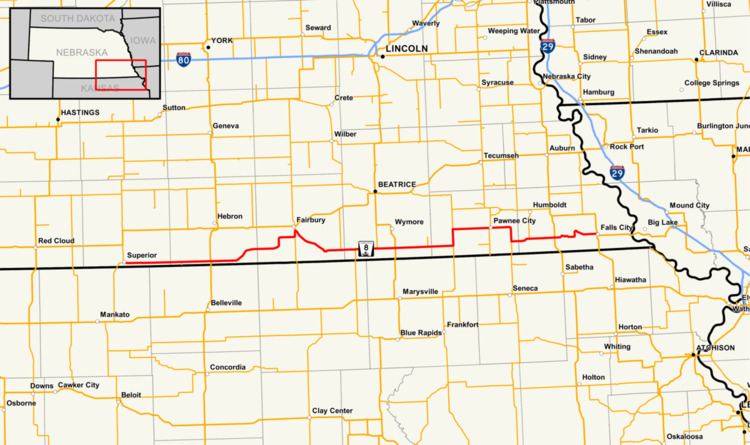 | ||
Nebraska Highway 8 (N-8) is a highway in southern and southeastern Nebraska. Its western terminus is at Nebraska Highway 14 in Superior and its eastern terminus is at U.S. Highway 73 (US 73) in Falls City. It runs through the southern tier of counties in Nebraska and is always within 10 miles (16 km) of the Kansas border.
Contents
Map of NE-8, Nebraska, USA
Route description
N-8 begins at N-14 in Superior and goes east through farmland until it meets US 81 in Chester. When the highway reaches Hubbell, it begins a segment where it goes northeasterly towards Fairbury until it meets N-15. It goes north with N-15 into Fairbury, crosses the Little Blue River, then turns southeast towards Steele City. It goes straight east through Odell and Barneston, passing US 77 between those two villages. At N-99, the highway turns north, overlapping N-99 for 5 miles (8.0 km). It then turns east towards Pawnee City. At Pawnee City, it meets N-50 and goes east and then south with it, separating just before Du Bois. It turns east, meets US 75 south of Dawson and ends in downtown Falls City at an intersection with US 73.
History
N-8 was previously Route 3S. N-8 was created in about 1960.