
Length 841 km | ||
 | ||
Primarydestinations: | ||
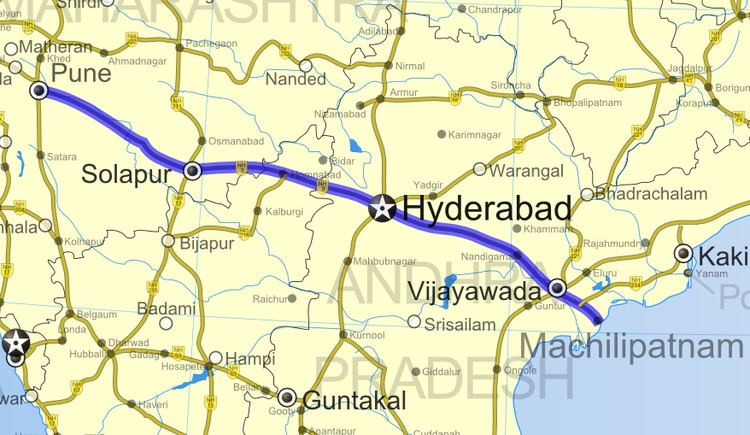
National Highway 65 (NH 65), (previously National Highway 9), is a National Highway in India. It runs along the states of Maharashtra, Karnataka, Telangana and Andhra Pradesh. It starts at Pune and ends at Machilipatnam. Major cities and towns on the route are Pune, Solapur, Umarga, Hyderabad, Suryapet, Kodad, Nandigama, Vijayawada, Vuyyuru and Machilipatnam.
Contents
Map of NH65
Route and length
In Andhra Pradesh, it has a total length of 145.75 km (90.56 mi).
References
National Highway 65 (India) Wikipedia(Text) CC BY-SA