
Population 10,665,939 | Area 51,336 km² | |
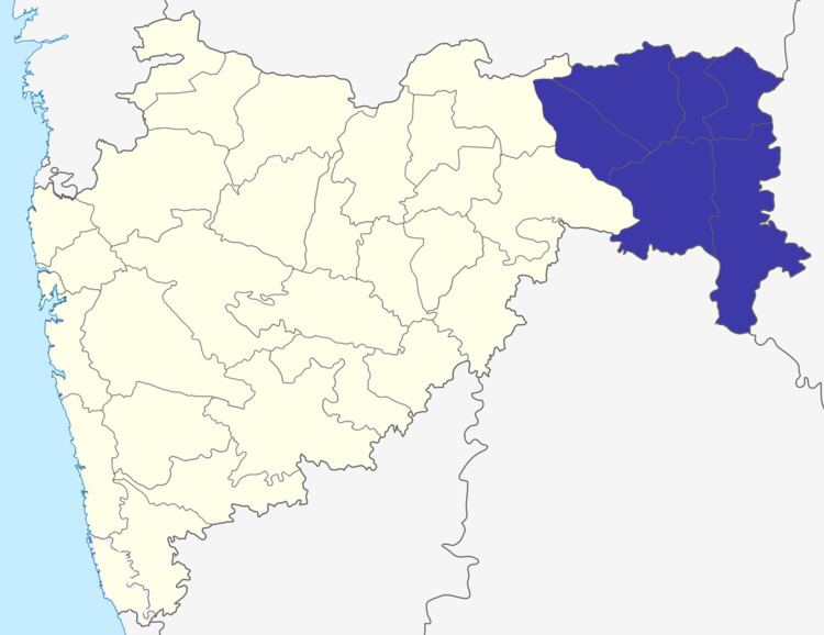 | ||
Districts 1. Bhandara, 2. Chandrapur, 3. Gadchiroli, 4. Gondia, 5. Nagpur, 6. Wardha | ||
Nagpur Division is one of six administrative divisions of Maharashtra State in India. Nagpur is the easternmost division in the state, with an administrative headquarters in the city of Nagpur. it covers 19,821 sq mi [51,336 km].Amravati and Nagpur divisions make up the region of Vidarbha.
Contents
History
Nagpur Division was created in 1861, when the Central Provinces administrative division of British India was created by merging the Nagpur Province and the Saugor and Nerbudda Territories. Before 1861, Nagpur Division had been part of Nagpur Province, which had been created after the Nagpur kingdom was annexed by the British in 1853 by means of the Doctrine of lapse. The British Nagpur Division included the current districts as well as Balaghat District, currently part of Madhya Pradesh.
After Indian Independence, The Central Provinces and Berar (Amravati Division) became the new state of Madhya Pradesh. The Indian states were reorganised along linguistic lines in 1956, and on November 1 Nagpur and Amravati Divisions were transferred to Bombay State, while Balaghat District remained in Madhya Pradesh. The Marathi-speaking portion of Bombay State became Maharashtra State in 1960.