
Country India Website Official website | Major highways NH-80, NH-333, NH-333B Average annual precipitation 1,146 | |
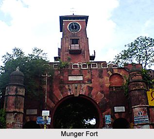 | ||
Points of interest Ganges, Munger Fort, Sita Kund, Pir Pahar & TV Tower | ||
Munger district is one of the thirty-eight districts of Bihar state in eastern India. Munger city is the administrative headquarters of this district. Munger district is a part of Munger Division. Its literacy rate of 73.3% is higher than the state literacy rate of 63.8% and lower than national rate of 74.04
Contents
Map of Munger, Bihar
History
Munger has seen five districts partitioned off from its territory: Begusarai in 1976; Khagaria in 1988; and Jamui in 1991; and Lakhisarai district and Sheikhpura in 1994.
The district is currently a part of the Red Corridor.
Geography
Munger District is located in the southern part of Bihar and its headquarters is located on the southern bank of river Ganges. Munger district occupies an area of 1,419 square kilometres (548 sq mi), comparatively equivalent to Russia's Urup Island.
Economy
In 2006, the Ministry of Panchayati Raj named Munger one of the country's 250 most backward districts (out of a total of 640). It is one of the 36 districts in Bihar currently receiving funds from the Backward Regions Grant Fund Programme (BRGF).
Demographics
According to the 2011 census Munger district has a population of 1,359,054, roughly equal to the nation of Swaziland or the US state of Hawaii. This gives it a ranking of 358th in India (out of a total of 640). The district has a population density of 958 inhabitants per square kilometre (2,480/sq mi) . Its population growth rate over the decade 2001-2011 was 19.45%. Munger has a sex ratio of 879 females for every 1000 males, and a literacy rate of 73.3%.
Languages
Main Languages used in the district include Hindi, Angika, an Indo-Aryan language written in the Devanagari script and spoken by at least 725,000 people in the Angika Region.
Flora and fauna
In 1976, Munger district became home to the Bhimbandh Wildlife Sanctuary, which has an area of 682 km2 (263.3 sq mi).