
Elevation 1,544 m | Prominence 21 m | |
 | ||
Similar Kawaikini, Pu'u Kukui, Haleakalā, Mauna Loa, Mauna Kea | ||
Mount Waiʻaleʻale (why ah lay ah lay), often spelled Waialeale in English without the ʻokina, is a shield volcano and the second highest point on the island of Kauaʻi in the Hawaiian Islands. Its name literally means "rippling water" or "overflowing water"
Contents
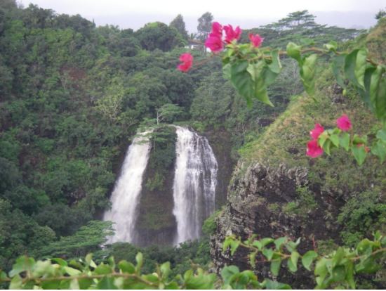
Map of Waialeale, Hawaii 96746, USA
The mountain, at an elevation of 5,148 feet (1,569 m), averages more than 452 inches (11,500 mm) of rain a year since 1912, with a record 683 inches (17,300 mm) in 1982; its summit is one of the rainiest spots on earth. Recent reports though mention that over the period 1978–2007 the wettest spot in Hawaii is Big Bog on Maui (404 inches or 10,300 mm per year).
Climate and Rainfall Statistics
The summit of Waiʻaleʻale features a tropical rainforest climate (Köppen Af), with substantial rainfall throughout the course of the year. (Bodin 1978: 272) quotes 460.0 inches (11,684 mm) per year figure as being the 1912–45 average, an average that quite possibly will have changed since then, while The National Climatic Data Center quotes this figure as a 30-year average. The Weather Network and The Guinness Book of Weather Records (Holford 1977: 240) quotes 451.0 inches (11,455 mm) rain per year, while (Ahrens 2000: 528) quotes 460 inches (11,680 mm) as the average annual rainfall at Mount Waialeale and (Kroll 1995: 188) claims 510 inches (13,000 mm) falls here. Similarly, The Weather Network and the Guinness Book of Weather Records quote 335 days with rain here while (Simons 1996: 303) suggests that rain falls on 360 days per year.
The local tourist industry of Waialeale has promoted it as the wettest spot, although the 38-year average at Mawsynram, Meghalaya, India is higher at 467.4 inches (11,870 mm). Both Mawsynram and Cherrapunji in Meghalaya are recognized by the Guinness Book of World Records as having higher average rainfall. Mawsynram's rainfall is concentrated in the monsoon season, while the rain at Waiʻaleʻale is more evenly distributed through the year.
Causes
Several factors give the summit of Waiʻaleʻale more potential to create precipitation than the rest of the island chain:
- Its northern position relative to the main Hawaiian Islands provides more exposure to frontal systems that bring rain during the winter.
- It has a relatively round and regular conical shape, exposing all sides of its peak to winds and the moisture that they carry.
- Its peak lies just below the so-called trade wind inversion layer of 6,000 feet (1,800 m), above which trade-wind-produced clouds cannot rise.
- And most importantly, the steep cliffs cause the moisture-laden air to rise rapidly – over 3,000 feet (910 m) in less than 0.5 miles (0.80 km) – and drop a large portion of its rain in one spot, as opposed to spreading the rain out over a larger area if the slope were more gradual.
Ecology
The great rainfall in the area produces the Alakaʻi Wilderness Preserve, a large boggy area that is home to many rare plants. The ground is so wet that although trails exist, access by foot to the Waiʻaleʻale area is extremely difficult.
A number of rare local plant species are named for this mountain, including Astelia waialealae, Melicope waialealae, and the endemic Dubautia waialealae.