
Elevation 1,419 m | Volcanic arc/belt Kurile arc Prominence 910 m | |
 | ||
Pronunciation Japanese: [unabetsudake] Topo map Geospatial Information Authority 25000:1 海別岳25000:1 朱円50000:1 斜里 Similar Mount Shari, Mount Shiretoko, Mount Onnebetsu, Mount Rausu, Mount Iō | ||
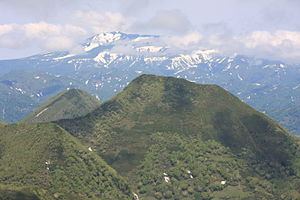
Mount Unabetsu (海別岳, Unabetsu-dake) is a quaternary stratovolcano. Its summit is 1,419.3 metres (4,656 ft). It is located on Hokkaido's Shiretoko Peninsula on the border of Shari in Shari District, Abashiri and Shibetsu in Shibetsu District, Nemuro.
Contents
Map of Mount Unabetsu, Shari, Shari District, Hokkaido Prefecture, Japan
Geology
The mountain is made mainly of andesite and basalt.
References
Mount Unabetsu Wikipedia(Text) CC BY-SA