
Listing Inactive volcanoUltra Prominence 2,290 m Mountain range Malindang Mountain Range | Elevation 2,404 m | |
 | ||
Parent range Malindang Mountain Range Similar Mount Kitanglad, Mount Apo, Mount Kalatungan, Mount Hamiguitan, Mount Matutum | ||
Mount Malindang is a complex volcano located in the province of Misamis Occidental in the southern island of Mindanao, Philippines. The least studied mountain range was formed through several volcanic activities some of which could be historical, evident by the presence of two calderas, surrounded by high rock walls, cinder cones, dome volcano plugs, two sulfurous hot springs, and a crater lake named Lake Duminagat. The amphitheater structures have extensive distribution of volcanic rocks, carbonized wood that are found in pyroclastic deposits. The entire mountain range is dissected by several canyons and ravines making its terrain very rugged and the forested slopes covered with beautiful scenery.
Contents
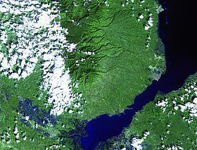
- Map of Mount Malindang Don Victoriano Chiongbian Misamis Occidental Philippines
- ClassificationEdit
- Mount Malindang Natural ParkEdit
- FaunaEdit
- Economic importanceEdit
- ASEAN Heritage ParkEdit
- References
Map of Mount Malindang, Don Victoriano Chiongbian, Misamis Occidental, Philippines
ClassificationEdit
Malindang has no known historical eruptions and is classified as inactive by the Philippine Institute of Volcanology and Seismology.
Mount Malindang Natural ParkEdit
Mount Malindang and the whole Malindang Mountain Range alluring qualities come from its waterfalls, crater lake and dense virgin forests which host diverse and rare species of flora and fauna. On June 19, 1971, the area was proclaimed as Mount Malindang National Park by virtue of Republic Act 6266. Under the establishment of National Integrated Protected Areas System (NIPAS) in 1992, the park was reclassified and was renamed as Mount Malindang Range Natural Park on August 2, 2002 through Proclamation No. 228.
The park is encompasses three provinces - Misamis Occidental, Zamboanga del Sur and Zamboanga del Norte - covering an area of 53,262 hectares (131,610 acres) of which about 33,000 hectares (82,000 acres) or 62% of forest remaining. About 20,000 hectares (49,000 acres) are cultivated and inhabited by indigenous people mostly the Subanon tribe.
FaunaEdit
The national park is known to harbor a rich and unique biodiversity that is yet to be explored. The mountain and its outlying areas, some are unexplored, are home to some of the endemic and endangered species in the Philippines, which include:.
Economic importanceEdit
Mount Malindang and its adjoining mountain range is a catchment area which drains water through 49 rivers and streams, and numerous creeks. It provides potable water for domestic, agricultural and other uses to more than one million inhabitants of Misamis Occidental and the eastern parts of Zamboanga del Norte and Zamboanga del Sur.
ASEAN Heritage ParkEdit
Declared as Association of Southeast Asian Nations (ASEAN) Heritage Park (AHP), during the 13th Informal ASEAN Ministerial Meeting on the Environment held October 13, 2011 in Cambodia. The three other Philippine AHPs are Mount Iglit-Baco National Park in Mindoro, Mount Kitanglad Range in Bukidnon, and Mount Apo Natural Park in Davao.
It was officially launched on August 4, 2012, during the 2nd National ASEAN Heritage Park (AHP) Conference, sponsored by the ASEAN Center for Bio-diversity (ACB) at Oroquieta City.