
Prominence 350 m Parent range Kitanglad Mountain Range | Elevation 2,899 m Mountain range Kitanglad Mountain Range | |
 | ||
Similar Mount Dulang‑dulang, Mount Kalatungan, Mount Apo, Mount Pulag, Mount Malindang | ||
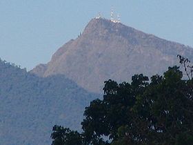
Mount Kitanglad is an inactive volcano located in the Kitanglad Mountain Range in Bukidnon province on Mindanao island. It is the fourth highest mountain in the Philippines and has an approximate height of 2,899 meters. It is located between Malaybalay City and the municipalities of Lantapan, Impasugong, Sumilao, and Libona.
Map of Mount Kitanglad, Sumilao, Bukidnon, Philippines
The name "Kitanglad" was derived from a legend that there was once a great flood that submerged the native lands of Bukidnon and only the tip of the mountain, the size of a "tanglad" (lemon grass), remained visible ("kita" in Visayan). It is considered as an ancestral domain of several old cultural communities like the Bukidnons, Higaonons and Talaandigs.
Mount Kitanglad was proclaimed a protected area under the natural park category through Presidential Proclamation 896 dated October 24, 1996. On November 9, 2000, Mt. Kitanglad finally became a full-pledge protected area when Congress approved R.A. 8978 also known as the Mt. Kitanglad Range Protected Area Act of 2000.
In 2009, Mount Kitanglad Range Natural Park (MKRNP) was declared as an ASEAN Heritage Park.