
Elevation 1,952 m | Last eruption 2000 | |
 | ||
Similar Mount Dempo, Sangeang Api, Geureudong, Mount Egon, Mount Talang | ||
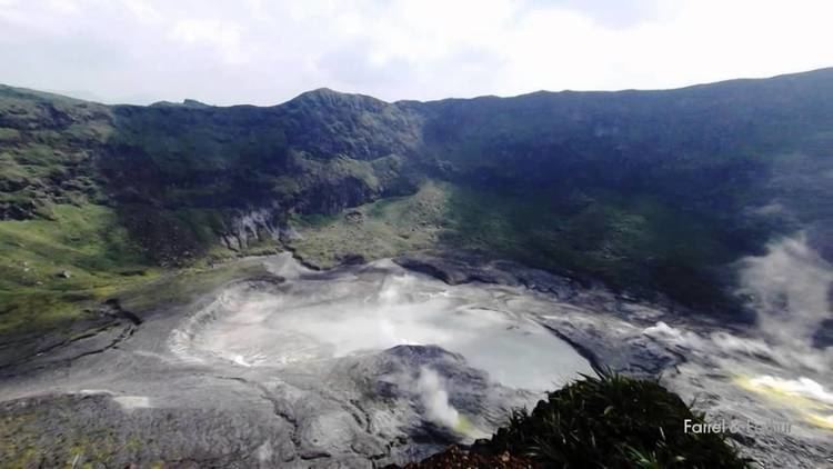
Mount kaba volcano
Kaba, a twin volcano with Mount Hitam in Bengkulu Province of Indonesia, has an elongated summit crater complex dominated by three large historically active craters trending ENE from the summit to the upper NE flank. The SW-most crater of Gunung Kaba, Kawah Lama, is the largest. Most historical eruptions have affected only the summit region of the volcano. They mostly originated from the central summit craters, although the upper-NE flank crater Kawah Vogelsang also produced explosions during the 19th and 20th centuries. In 1833 an eruption ejected water from the crater lake, forming lahars that produced damage and fatalities at Talang, Klingi, and Bliti villages.
Contents
- Mount kaba volcano
- Map of Mount Kaba Sambirejo Selupu Rejang Rejang Lebong Regency Bengkulu Indonesia
- timelapse bangun tenda mount kaba curup bengkulu gopro hero 4 black
- References
Map of Mount Kaba, Sambirejo, Selupu Rejang, Rejang Lebong Regency, Bengkulu, Indonesia
timelapse bangun tenda mount kaba curup bengkulu gopro hero 4 black
References
Mount Kaba Wikipedia(Text) CC BY-SA