
Last eruption 2008 | Elevation 1,703 m | |
 | ||
Similar Lewotobi, Mount Awu, Paluweh, Inielika, Dukono | ||
Mount egon flores
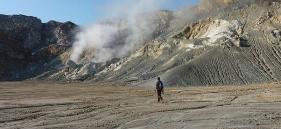
Mount Egon (Gunung Egon, sometimes also called Gunung Namang) is a stratovolcano located in the southeastern part of the island of Flores, Indonesia in the area of Maumere bay. A landslide during the eruption on 29 January 2004 forced 6,000 people to evacuate the area. Activity of Gunung Egon on 15 April 2008 forced thousands of people to evacuate. Quakes and fumes from the volcano have been occurring since November 2010, designating Egon as one of 11 volcanoes in Indonesia on the highest level alert.
Contents
- Mount egon flores
- Map of Mount Egon Nangatobong Waigete Sikka Regency East Nusa Tenggara Indonesia
- Leonen on poe civilians vs isis indonesia s mount egon 12pm wrap
- References
Map of Mount Egon, Nangatobong, Waigete, Sikka Regency, East Nusa Tenggara, Indonesia
Leonen on poe civilians vs isis indonesia s mount egon 12pm wrap
References
Mount Egon Wikipedia(Text) CC BY-SA