
Last eruption 2007 | Elevation 2,597 m | |
 | ||
Similar Mount Marapi, Mount Tandikat, Mount Talakmau, Mount Singgalang, Mount Gamkonora | ||
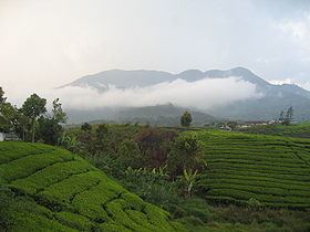
Mount Talang (Indonesian: Gunung Talang) (2,597 m) is an active stratovolcano in West Sumatra, Indonesia. Talang has two crater lakes on its flanks, the largest of which is 1 x 2 km wide and is called Lake Talang.
Contents
- Map of Mount Talang Air Batumbuk Gunung Talang Solok West Sumatra Indonesia
- Mount talang from solok to the top
- References
Map of Mount Talang, Air Batumbuk, Gunung Talang, Solok, West Sumatra, Indonesia
According to the Smithsonian Institution Global Volcanism Program, Mount Talang has had eight confirmed eruptions between 1833 and 1968. A minor eruption followed in April 2005, over 25,000 inhabitants of the local area being evacuated due to fears of further volcanic eruptions. Geologists say that the eruption in April 2005 is connected to the devastating December 2004 Indian Ocean earthquake.
The pitcher plant Nepenthes talangensis is named after the mountain and is thought to be endemic to its upper slopes.
Mount talang from solok to the top
References
Mount Talang Wikipedia(Text) CC BY-SA