
Traversed by Unpaved road Elevation 4,019 m | Topo map USGS Climax | |
 | ||
Similar Rocky Mountains, National Mining Hall of Fame, Temple Israel, Hagerman Pass, Imogene Pass | ||
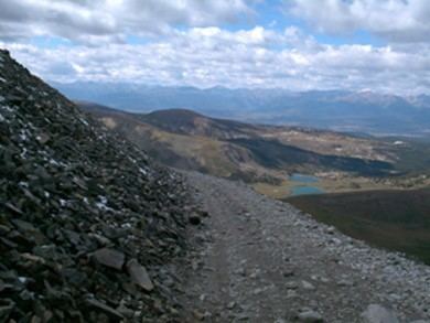
Mosquito Pass, elevation 13,185 ft (4,019 m), is a high mountain pass in the Mosquito Range of central Colorado in the United States. It lies on the boundary between Lake and Park counties between Leadville (west) and Fairplay (east). It also lies on the divide between the Arkansas and South Platte Rivers, which is the informal demarcation between the northern and southern parts of Colorado east of the Continental Divide.
Map of Mosquito Pass, Colorado 80461, USA
One of the highest passes in the state, Mosquito Pass can be traversed only on foot, on an offroad motorcycle or with a proper four-wheel drive (4WD) vehicle. 2WD vehicles will find the road difficult due to the stream crossings and high rocky sections. Even with 4WD, it is typically passable only during the summer months.
The pioneering Methodist circuit rider John Lewis Dyer crossed over Mosquito Pass several times a week during the 1860s, using snowshoes in winter, in his mission to spread the gospel. Father Dyer Peak is named in his honor.