
Country United States County Morris Area 5.746 km² Population 6,617 (2013) | Zip code 07885 Local time Saturday 12:23 PM | |
 | ||
Incorporated June 26, 1895 as Port Oram Renamed April 16, 1902 as Wharton Weather 6°C, Wind N at 16 km/h, 71% Humidity | ||
Wharton new jersey 07885
Wharton is a borough in Morris County, New Jersey, United States. As of the 2010 United States Census, the borough's population was 6,522, reflecting an increase of 224 (+3.6%) from the 6,298 counted in the 2000 Census, which had in turn increased by 893 (+16.5%) from the 5,405 counted in the 1990 Census.
Contents
- Wharton new jersey 07885
- Map of Wharton NJ USA
- History
- Geography
- Climate
- 2010 Census
- 2000 Census
- Local government
- Federal state and county representation
- Politics
- Education
- Roads and highways
- Public transportation
- Notable people
- References
Map of Wharton, NJ, USA
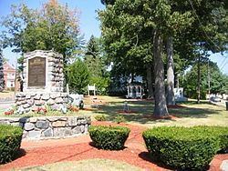
Wharton was originally incorporated as the borough Port Oram by an act of the New Jersey Legislature on June 26, 1895, created from portions of Randolph Township and Rockaway Township, subject to the results of a referendum passed on the previous day; the name was changed to Wharton on April 16, 1902, based on a referendum held that day and subject to legislation passed on March 27, 1902. The borough was named for Joseph Wharton of the Wharton Steel Company.
History
In 1831, the Morris Canal was completed from Newark to Phillipsburg, New Jersey across the Delaware River from the terminus of the Lehigh Canal. On the way, it passed through Boonton, Dover and Port Oram. On this route it tapped the Morris County ore fields and became a carrier for both ore and pig iron. Its main purpose, however, was as an extension of the Lehigh Canal to furnish a route for anthracite coal from the Pennsylvania mines to seaboard. Any local traffic was a gain to supplement the through anthracite freight and iron ore and its products soon became important sources of revenue. Sites on the canal were selected for docks and industry, including iron works.
On June 28, 1895, voters from the settlements Port Oram, Irondale, Luxemburg, Maryville and Mount Pleasant voted 143 to 51 to incorporate as the borough Port Oram, the largest of the communities in the area covering 2.25 square miles (5.8 km2) west of Dover, New Jersey. A mayor, six councilmen, an assessor and a collector were elected to govern the new borough which had started life as an ore shipping port on the Morris Canal. These elected officials (mine superintendents, store owners, a railroad superintendent and a school teacher) represented the leaders of these settlements where iron ore was mined, smelted and shipped.
The borough was renamed in 1902 in honor of Joseph Wharton, who was born in 1826 in Philadelphia to an old family of Quakers. Wharton first studied at a local Quaker school after which he worked on a farm rather than attend college because his parents wanted him to mature, and during the winter studied chemistry at the laboratory of Martin Hans Boyè in Philadelphia. He started producing zinc and nickel, and gradually bought a controlling interest in Bethlehem Iron Works. As his business interests expanded he purchased substantial shares of several railroads involved in the coal and iron trade, also purchasing iron mines and furnaces near Port Oram. After selling his interest in Bethlehem Iron Works in 1901 and his nickel works to CVRD Inco in 1902, he continued to actively acquire and manage a large and diverse business empire that included iron smelting in Wharton until just before his death in January, 1909. Wharton also endowed the Wharton School of the University of Pennsylvania. The town was named after him at after a referendum in 1902.
In 1984, the long-time local bar The Heslin House and Hartley's Store were destroyed in a gas leak explosion, in which flames as high as 100 feet (30 m) destroyed several area buildings.
Wharton was used as a filming location for Cyndi Lauper's music video "Time After Time" in 1984.
Geography
According to the United States Census Bureau, the borough had a total area of 2.219 square miles (5.746 km2), including 2.146 square miles (5.558 km2) of land and 0.073 square miles (0.188 km2) of water (3.27%).
The borough borders the Morris County municipality of Dover.
Unincorporated communities in the borough include Irondale, Luxemburg, Maryville, Mount Pleasant and Port Oram.
Climate
The climate in this area is characterized by hot, humid summers and generally mild to cool winters. According to the Köppen Climate Classification system, Wharton has a humid subtropical climate, abbreviated "Cfa" on climate maps.
2010 Census
The 2010 United States Census counted 6,522 people, 2,304 households, and 1,590 families residing in the borough. The population density was 3,039.0 per square mile (1,173.4/km2). The borough contained 2,426 housing units at an average density of 1,130.4 per square mile (436.4/km2). The racial makeup of the borough was 75.85% (4,947) White, 4.57% (298) Black or African American, 0.18% (12) Native American, 5.67% (370) Asian, 0.06% (4) Pacific Islander, 9.61% (627) from other races, and 4.05% (264) from two or more races. Hispanics or Latinos of any race were 40.33% (2,630) of the population.
Out of a total of 2,304 households, 33.5% had children under the age of 18 living with them, 48.1% were married couples living together, 14.8% had a female householder with no husband present, and 31.0% were non-families. 25.0% of all households were made up of individuals, and 10.7% had someone living alone who was 65 years of age or older. The average household size was 2.83 and the average family size was 3.34.
In the borough, 23.9% of the population were under the age of 18, 8.4% from 18 to 24, 28.6% from 25 to 44, 27.4% from 45 to 64, and 11.7% who were 65 years of age or older. The median age was 38.2 years. For every 100 females the census counted 96.9 males, but for 100 females at least 18 years old, it was 92.7 males.
The Census Bureau's 2006-2010 American Community Survey showed that (in 2010 inflation-adjusted dollars) median household income was $73,571 (with a margin of error of +/- $8,504) and the median family income was $75,176 (+/- $9,601). Males had a median income of $48,750 (+/- $12,951) versus $31,105 (+/- $5,994) for females. The per capita income for the borough was $27,233 (+/- $2,723). About 6.6% of families and 6.8% of the population were below the poverty line, including 8.6% of those under age 18 and 0.0% of those age 65 or over.
2000 Census
As of the 2000 United States Census there were 6,298 people, 2,328 households, and 1,599 families residing in the borough. The population density was 2,882.4 people per square mile (1,110.4/km2). There were 2,394 housing units at an average density of 1,095.6 per square mile (422.1/km2). The racial makeup of the borough was 82.09% White, 4.40% African American, 0.44% Native American, 3.14% Asian, 7.21% from other races, and 2.72% from two or more races. Hispanic or Latino of any race were 23.21% of the population.
There were 2,328 households out of which 34.6% had children under the age of 18 living with them, 52.1% were married couples living together, 12.0% had a female householder with no husband present and 31.3% were non-families. 26.5% of all households were made up of individuals and 10.4% had someone living alone who was 65 years of age or older. The average household size was 2.70 and the average family size was 3.28.
In the borough the population was spread out with 26.0% under the age of 18, 6.8% from 18 to 24, 34.0% from 25 to 44, 21.9% from 45 to 64, and 11.3% who were 65 years of age or older. The median age was 36 years. For every 100 females there were 93.5 males. For every 100 females age 18 and over, there were 88.8 males.
The median income for a household in the borough was $56,580, and the median income for a family was $64,957. Males had a median income of $42,311 versus $36,016 for females. The per capita income for the borough was $25,168. About 6.4% of families and 8.3% of the population were below the poverty line, including 15.0% of those under age 18 and 4.2% of those age 65 or over.
Local government
Wharton is governed under the Borough form of New Jersey municipal government. The governing body consists of a Mayor and a Borough Council comprising six council members, with all positions elected at-large on a partisan basis as part of the November general election. A Mayor is elected directly by the voters to a four-year term of office. The Borough Council consists of six members elected to serve three-year terms on a staggered basis, with two seats coming up for election each year in a three-year cycle. The Borough form of government used by Maywood, the most common system used in the state, is a "weak mayor / strong council" government in which council members act as the legislative body with the mayor presiding at meetings and voting only in the event of a tie. The mayor can veto ordinances subject to an override by a two-thirds majority vote of the council. The mayor makes committee and liaison assignments for council members, and most appointments are made by the mayor with the advice and consent of the council.
As of 2016, the Mayor of Wharton is Republican Bill Chegwidden, whose term of office ends December 31, 2018. Members of the Borough Council are Council President Nicole Wickenheisser (R, 2018), Vincent Binkoski (R, 2017), Glenn Corbett (R, 2016), Sandra L. Hayes (R, 2017), Robert Norton (R, 2016) and Thomas C. Yeager (R, 2018).
Dover serves as the lead agency operating a joint municipal court that includes Wharton and the neighboring municipalities of Mine Hill Township, Mount Arlington and Victory Gardens. Established in 2009, the joint municipal court was forecast to offer annual savings in excess of $250,000 over the 10-year life of the agreement.
Federal, state and county representation
Wharton is located in the 7th Congressional District and is part of New Jersey's 25th state legislative district. Prior to the 2010 Census, Wharton had been part of the 11th Congressional District, a change made by the New Jersey Redistricting Commission that took effect in January 2013, based on the results of the November 2012 general elections.
New Jersey's Seventh Congressional District is represented by Leonard Lance (R, Clinton Township). New Jersey is represented in the United States Senate by Cory Booker (D, Newark, term ends 2021) and Bob Menendez (D, Paramus, 2019).
For the 2016–2017 session (Senate, General Assembly), the 25th Legislative District of the New Jersey Legislature is represented in the State Senate by Anthony Bucco (R, Boonton Town) and in the General Assembly by Tony Bucco (R, Boonton Township) and Michael Patrick Carroll (R, Morris Township). The Governor of New Jersey is Chris Christie (R, Mendham Township). The Lieutenant Governor of New Jersey is Kim Guadagno (R, Monmouth Beach).
Morris County is governed by a seven-member Board of Chosen Freeholders, who are elected at-large to three-year terms on a staggered basis, with either two or three seats up for election each year as part of the November general election. The Freeholder Board sets policies for the operation of six super-departments, more than 30 divisions plus authorities, commissions, boards and study committees. Actual day-to-day operation of departments is supervised by County Administrator, John Bonanni. As of 2016, Morris County's Freeholders are Freeholder Director Kathryn A. DeFillippo (Roxbury Township, term ends December 31, 2016), Deputy Freeholder William "Hank" Lyon (Montville, 2017), Douglas Cabana (Boonton Township, 2016), John Cesaro (Parsippany-Troy Hills Township, 2018), Thomas J. Mastrangelo (Montville, 2016) Christine Myers (Mendham Township, 2018), and Deborah Smith (Denville, 2018). Constitutional officers are County Clerk Ann F. Grossi (Parsippany-Troy Hills Township, 2018), Sheriff Edward V. Rochford (Morris Plains, 2016) and Surrogate John Pecoraro (Mendham Borough, 2019).
Politics
As of March 23, 2011, there were a total of 3,258 registered voters in Wharton, of which 923 (28.3%) were registered as Democrats, 935 (28.7%) were registered as Republicans and 1,397 (42.9%) were registered as Unaffiliated. There were 3 voters registered to other parties.
In the 2012 presidential election, Democrat Barack Obama received 56.0% of the vote (1,310 cast), ahead of Republican Mitt Romney with 43.0% (1,006 votes), and other candidates with 1.0% (24 votes), among the 2,359 ballots cast by the borough's 3,455 registered voters (19 ballots were spoiled), for a turnout of 68.3%. In the 2008 presidential election, Democrat Barack Obama received 51.8% of the vote (1,326 cast), ahead of Republican John McCain with 47.0% (1,202 votes) and other candidates with 0.7% (19 votes), among the 2,559 ballots cast by the borough's 3,432 registered voters, for a turnout of 74.6%. In the 2004 presidential election, Republican George W. Bush received 54.4% of the vote (1,334 ballots cast), outpolling Democrat John Kerry with 44.6% (1,092 votes) and other candidates with 0.5% (16 votes), among the 2,451 ballots cast by the borough's 3,510 registered voters, for a turnout percentage of 69.8.
In the 2013 gubernatorial election, Republican Chris Christie received 65.9% of the vote (892 cast), ahead of Democrat Barbara Buono with 32.1% (434 votes), and other candidates with 2.0% (27 votes), among the 1,381 ballots cast by the borough's 3,449 registered voters (28 ballots were spoiled), for a turnout of 40.0%. In the 2009 gubernatorial election, Republican Chris Christie received 52.9% of the vote (848 ballots cast), ahead of Democrat Jon Corzine with 36.6% (586 votes), Independent Chris Daggett with 8.6% (137 votes) and other candidates with 1.1% (17 votes), among the 1,602 ballots cast by the borough's 3,357 registered voters, yielding a 47.7% turnout.
Education
The Wharton Borough School District serves public school students in kindergarten through eighth grade. As of the 2014-15 school year, the district and its two schools had an enrollment of 1,106 students and 75.6 classroom teachers (on an FTE basis), for a student–teacher ratio of 14.6:1. Schools in the district (with 2014-15 enrollment data from the National Center for Education Statistics) are Marie V. Duffy Elementary School (488 students in grades K - 5) and Alfred C. MacKinnon Middle School (292 students in grades 6 - 8).
Public school students in ninth through twelfth grades attend Morris Hills High School, located in Rockaway Borough, and which also serves portions of Rockaway Borough and Rockaway Township. As of the 2014-15 school year, the high school had an enrollment of 1,202 students and 108.0 classroom teachers (on an FTE basis), for a student–teacher ratio of 11.1:1. The high school is part of the Morris Hills Regional High School District, which also includes students from Denville Township, who attend Morris Knolls High School along with students from parts of Rockaway Borough and Rockaway Township.
Roads and highways
As of May 2010, the borough had a total of 22.12 miles (35.60 km) of roadways, of which 16.67 miles (26.83 km) were maintained by the municipality, 3.31 miles (5.33 km) by Morris County and 2.14 miles (3.44 km) by the New Jersey Department of Transportation.
Public transportation
NJ Transit offers local bus service on the 880 route, which largely replaced the previous MCM10 route.
Notable people
People who were born in, residents of, or otherwise closely associated with Wharton include: