
Prominence 1,581 m Listing Ultra-prominent peak | Elevation 3,383 m | |
 | ||
Similar Gunnbjørn Fjeld, Petermann Peak, Pisissarfik, Qalorujoorneq, Mount Odin | ||
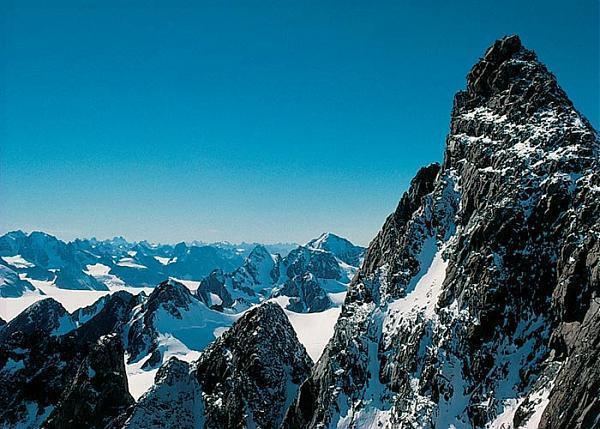
Mont Forel is a mountain in King Christian IX Land, Sermersooq Municipality, Greenland. It is part of the Schweizerland range, also known as 'Schweizerland Alps'.
Contents
Map of Mont Forel, Greenland
This peak is located in a popular climbing destination, together with the Watkins Range to the northeast and the Stauning Alps further north.
HistoryEdit
The mountain was named in 1912 by Swiss geophysicist and Arctic explorer Alfred De Quervain after his Greenland icecap crossing from Godhavn (Qeqertarsuaq) on the west, to Sermilik Fjord on the eastern side.
Mont Forel was first climbed by a Swiss expedition of the Akademischer Alpen-Club of Zürich led by André Roch in 1938.
GeographyEdit
Mont Forel is the highest peak outside of the area of the Watkins Range, where the highest mountain, Gunnbjørn Fjeld rises. It is located just north of the Arctic Circle in the Schweizerland Alps, north of Sermilik, near Ammassalik Island. Its elevation is 3,383 metres (11,099 ft) and there is an ice dome at the top of the mountain. The Crown Prince Frederick Range stretches northeastwards to the northeast of Mont Forel.