
Prominence 3,694 m First ascent date August 16, 1935 | Elevation 3,694 m | |
 | ||
Isolation 3,254 kilometres (2,022 mi) Listing Highest ocean islands 11thWorld most prominent peaks 43rdWorld most isolated peaks 9thCountry high point Similar Mont Forel, Qaqqaq Kershaw, Møllehøj, Mount Logan, Mount Marcus Baker | ||
Gunnbjørn Fjeld (also called only Gunnbjørn) is Greenland's highest mountain and also the highest mountain north of the Arctic circle.
Contents
Map of Gunnbj%C3%B8rn Fjeld, Greenland
This mountain's name refers to the mythical Norse Hvitserk, literally meaning "whiteshirt", of the Icelandic Sagas. It is a nunatak, a rocky peak protruding through glacial ice.
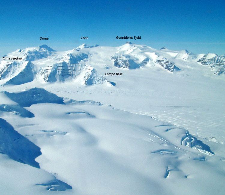
Geography
Gunnbjørn Fjeld is located in the Watkins Range, an area of nunataks on the east coast, which contains several other summits above 3,500 metres. Its height is often given as 3,700 metres (12,100 ft), although figures vary slightly.
History
Gunnbjørn Fjeld was first climbed on 16 August 1935 by Augustine Courtauld, Jack Longland, Ebbe Munck, Harold G. Wager, and Lawrence Wager. It is named after Gunnbjorn Ulfsson, the first European to have sighted Greenland.
The peak rises in an uninhabited part of the eastern coast of Greenland. The mountain is not so often climbed owing to its remote location. Access is often done with helicopter or ski-equipped plane (normally from Iceland).