
Traversed by US 50 Elevation 3,448 m | Topo map USGS Pahlone Peak Road U.S. Route 50 | |
 | ||
Similar Monarch Ski Area, Rocky Mountains, Cottonwood Pass, Marshall Pass, Wolf Creek Pass | ||
Colorado monarch pass winter
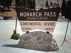
Monarch Pass, elevation 11,312 feet (3,448 m), is a high mountain pass in the Rocky Mountains of south-central Colorado in the United States.
Contents
- Colorado monarch pass winter
- Map of Monarch Pass Colorado 81201 USA
- My slideshow visiting monarch pass colorado continental divide 11 312 ft
- Location and basic detailsEdit
- SceneryEdit
- Old Monarch PassEdit
- Weather stationEdit
- References
Map of Monarch Pass, Colorado 81201, USA
My slideshow visiting monarch pass colorado continental divide 11 312 ft
Location and basic detailsEdit
The pass is located on the Continental Divide at the southern end of the Sawatch Range along the border between Gunnison and Chaffee counties, approximately 25 miles (40 km) west of the town of Salida. The pass carries U.S. Highway 50 over the Sawatch Range, providing a route between Tomichi Creek in the upper basin of the Gunnison River on the west and the South Arkansas River, a tributary of the Arkansas River, on the east. The pass can be traversed by all vehicles under most conditions and is generally open year-round; however, 7% grades exist, and the area is prone to heavy winter snowfall, often resulting in temporary closures during severe winter storms. Ramps for runaway trucks are located about halfway down both the eastern and western sides of the pass.
SceneryEdit
The pass is widely considered one of the most scenic in Colorado, offering a panoramic view of the southern end of the Sawatch Range from the summit. Monarch Mountain Lodge is located about 5 miles from the summit of the pass. During the summer, an aerial tram from the parking lot at the summit carries visitors to the top of Monarch Ridge above the pass (at approximately 12,000 feet (3,700 m) above sea level), allowing a wider view of the surrounding peaks. During the winter, visitors enjoy skiing at Monarch ski area.
Old Monarch PassEdit
An unpaved road over Old Monarch Pass, elevation 11,365 feet (3,464 m), connects to U.S. 50 on both sides of the Divide. This road can be traversed by passenger vehicles at most times during the summer and early fall months. However, heavy rainfalls occasionally wash out the east entrance to the pass. Check with a local ranger station for current conditions.
Weather stationEdit
An automated weather station (AWOS), provided by the Federal Aviation Administration, is located atop Monarch Pass, broadcasting at 124.175 mHz, providing pilots of small aircraft access to real-time weather conditions near the summit. The high terrain and frequent storms, however, make this route problematic for light aircraft; the pass is steep and narrow, especially when approached from the east, with a sharp turn required at the summit. Aircraft accidents in the vicinity of Monarch Pass are frequent. Many Colorado pilots suggest that small aircraft avoid Monarch and, whenever possible, make use of the lower, flatter Marshall Pass just a few miles to the south.
On February 17, 2016 at 7:36 p.m. the weather station recorded a wind gust from the west of 148 mph, the highest official gust recorded to date in the state of Colorado by the National Weather Service (NWS). The 148 mph gust broke the previous record of 147 mph from January 25, 1971 recorded by the Center for Atmospheric Research (NCAR). Both measures confirmed by the Colorado Division of Aeronautics as well as the NWS office in Pueblo, Colorado.