
Elevation 3,696 m | Range Rocky Mountains | |
 | ||
Traversed by Chaffee County Road 306 Location Chaffee–Gunnison counties, Colorado, U.S. Similar Rocky Mountains, Monarch Pass, Independence Pass, Mount Princeton, Mount Yale | ||
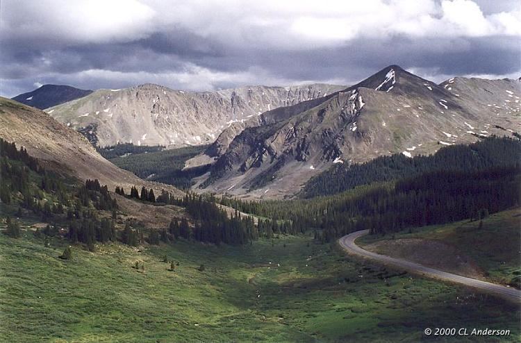
Cottonwood Pass (elevation 12,126 feet (3,696 m)) is a high mountain pass in the Rocky Mountains of south-central Colorado, United States. It is located near the border of Gunnison and Chaffee counties in Colorado and is in the Sawatch Range. The area surrounding the pass is mostly forest, with the San Isabel National Forest to the east and the Gunnison National Forest to the west.
Contents
Map of Cottonwood Pass, Colorado 81211, USA
The Continental Divide is marked at the saddle point of Cottonwood Pass. The pass is closed seasonally due to heavy snowfall, typically from around October until sometime in May. When open, the pass can be accessed from Buena Vista to the east by following Chaffee County Road 306. Near the summit, the road name changes to Gunnison County Road 209 as it continues to the west, passing near Taylor Park Reservoir and continuing down into the town of Almont. The majority of this road is paved, with the exception being the section linking the summit of Cottonwood Pass with Taylor Park Reservoir, which is gravel. When open, the pass is one of the few routes through the Sawatch Range accessible in a standard two-wheel drive passenger vehicle. Independence Pass is another such seasonal route through this mountain range, while efforts are made to ensure that U.S. 50 at Monarch Pass remains open year-round for all vehicles, barring extreme weather conditions.
Mudslides
In July 2002, heavy rains from a thunderstorm east of Cottonwood Pass caused a significant mudslide that blocked portions of Chaffee County Road 306 for many days. The National Weather Service estimated that between three and four inches of rain fell within one hour on the evening of 22 July 2002, causing a portion known as Red Deer Mountain to begin sliding downward and leaving debris up to 15 feet deep on the road. Several people were rescued from their vehicles after becoming trapped by the mud, but no fatalities were reported. Other mudslides caused by slow-moving thunderstorms have occurred near this area in both 2004 and 2007.