
Founded February 10, 1879 Congressional district 5th Website www.chaffeecounty.org Population 18,510 (2013) | Area 2,629 km² County seat Salida Unemployment rate 4.1% (Apr 2015) | |
 | ||
Points of interest Browns Canyon National, Collegiate Peaks, Monarch Ski Area, Arkansas Headwaters Recreatio, Cottonwood Pass | ||
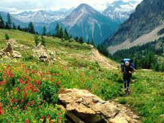
Grizzly lake chaffee county colorado
Chaffee County is one of the 64 counties of the U.S. state of Colorado. As of the 2010 census, the population was 17,809. The county seat is Salida.
Contents
- Grizzly lake chaffee county colorado
- Map of Chaffee County CO USA
- History
- Geography
- National protected areas
- Recreation area
- Trails
- Bicycle routes
- Adjacent counties
- Demographics
- City
- Towns
- Census designated places
- Ghost towns
- References
Map of Chaffee County, CO, USA
History
Chaffee County has a confusing origin. Between February 8 and February 10, 1879, Carbonate County was created by the Colorado legislature out of northern Lake County. On February 10 the two counties were renamed, with the southern part of Lake County becoming Chaffee County, and Carbonate County becoming Lake County. Chaffee County is known as the “Heart of the Rockies”. It was named for Jerome B. Chaffee, Colorado's first United States Senator.
Geography
According to the U.S. Census Bureau, the county has a total area of 1,015 square miles (2,630 km2), of which 1,013 square miles (2,620 km2) is land and 1.6 square miles (4.1 km2) (0.2%) is water.
National protected areas
Recreation area
Trails
Bicycle routes
Adjacent counties
Demographics
As of the census of 2000, there were 16,242 people, 6,584 households, and 4,365 families residing in the county. The population density was 16 people per square mile (6/km²). There were 8,392 housing units at an average density of 8 per square mile (3/km²). The racial makeup of the county was 90.94% White, 1.58% Black or African American, 1.09% Native American, 0.44% Asian, 0.05% Pacific Islander, 4.21% from other races, and 1.69% from two or more races. 8.58% of the population were Hispanic or Latino of any race.
There were 6,584 households out of which 25.20% had children under the age of 18 living with them, 56.70% were married couples living together, 6.80% had a female householder with no husband present, and 33.70% were non-families. 28.40% of all households were made up of individuals and 11.20% had someone living alone who was 65 years of age or older. The average household size was 2.26 and the average family size was 2.77.
In the county, the population was spread out with 19.70% under the age of 18, 7.70% from 18 to 24, 28.00% from 25 to 44, 27.50% from 45 to 64, and 17.00% who were 65 years of age or older. The median age was 42 years. For every 100 females there were 113.60 males. For every 100 females age 18 and over, there were 116.20 males.
The median income for a household in the county was $34,368, and the median income for a family was $42,043. Males had a median income of $30,770 versus $22,219 for females. The per capita income for the county was $19,430. About 7.40% of families and 11.70% of the population were below the poverty line, including 17.30% of those under age 18 and 10.20% of those age 65 or over.
Chaffee County is also home to a source of water that Arrowhead water uses for some water bottles. The source is Ruby Mountain Springs.