
Basin area 451.7 km² | - elevation 809 ft (247 m) - elevation 584 ft (178 m) | |
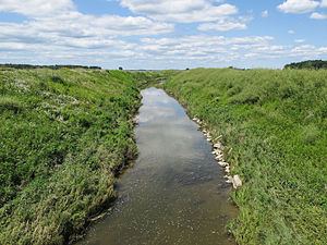 | ||
Misteguay Creek is a tributary of the Flint River, 38.4 miles (61.8 km) long, on the central Lower Peninsula of Michigan in the United States. The stream drains an area of 174.4 square miles (452 km2) in predominantly agricultural areas of the Flint/Tri-Cities region. Via the Flint and Shiawassee rivers, it is part of the watershed of the Saginaw River, which flows to Saginaw Bay of Lake Huron. Via Lake Huron and the Great Lakes system, it is part of the larger watershed of the St. Lawrence River.
Contents
Map of Misteguay Creek, Michigan, USA
Misteguay Creek begins in Clayton Township in Genesee County, approximately 1.9 miles (3.1 km) southeast of the village of Lennon and 3.5 miles (5.6 km) west of the city of Swartz Creek. It flows initially northwestward into Shiawassee County, then generally northward, through Venice and Hazelton townships and the village of New Lothrop in Shiawassee County; and Maple Grove, Albee, and Spaulding townships in Saginaw County. It flows into the Flint River in Spaulding Township, approximately 6.3 miles (10.1 km) east of the city of St. Charles. Several sections of the creek's course have been channelized.
TributariesEdit
This is a list of named streams in Misteguay Creek's watershed, as identified by the National Hydrography Dataset. By default, the list is ordered from the mouth of the creek to its source.