Country Languages spoken Hindi, Bhojpuri | State Literacy 68.48% (2011) (78.97%?; 56.86%?) | |
Mirzapur (Hindi:?????????) is a city in Uttar Pradesh, India, roughly 650 km from both Delhi and Kolkata, almost 90 km from Allahabad and 50 km from Varanasi. It has a population of 233,691 (2011 census) and is known for its carpet and brassware industries. The city is surrounded by several hills and is the headquarters of Mirzapur District and is famous for the holy shrine of Vindhyachal. It has many waterfalls and natural spots.It was once the largest district in India.
Contents
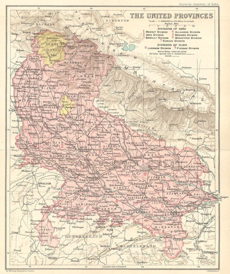
- Map of Mirzapur
- Rajdari water fall mirzapur
- Litti chokha party at lakhaniya dari waterfall ahraura near chunar mirzapur up
- History
- Geography
- Tourism
- Culture
- References
Map of Mirzapur
Rajdari water fall mirzapur
Litti chokha party at lakhaniya dari waterfall ahraura near chunar mirzapur up
History
According to several recorded facts, the Mirzapur was established by the British East India Company in 1735 while the civilization at here was found in 5000 BCE. As a proof of the existence of the lower Paleolithic age culture, the artifacts of prehistoric caves, the painted rocks and other evidences in the Belan River Valley (Belan River, Halia). Here we can find the evidences that are more than 17000 BCE. Some interesting petroglyphs in the sandstone of the Vindhya range are found in Morhana Pahar in Mirzapur district. The depictions of chariots, horses, weapons and people in these works have given rise varied interpretations and findings by historians.
Before the establishment of the town the area was dense forest and freely used by various states like Benaras (Varanasi), Sakteshgadh, Vijay Gadh, Naina Gadh (Chunar), Naugadh, Kantit and Rewa for Hunting. British East India Company has established this area to fulfill the need of a trading center between central and western India. This time Rewa was a well-established state of central India and was directly connected with Mirzapur by the Great Deccan Road. Over the time Mirzapur became a famous trading center of Central India and started trading of cotton, and silk at very large scale.
The East India Company named this place as Mirzapore (??????????). The word Mirzapur is derived from Mirza which in turn is derived from the Persian term ‘Amirzade which literally means "child of the ‘Amir" or "child of the ruler". In Persia‘ Amirzad in turn consists of the Arabic title ‘Amir (english. "Emir"), meaning "commander", and the Persian suffix -zad, meaning "birth" or "lineage". Due to vowel harmony in Turkic languages, the alternative pronunciation Morza (plural morzalar; derived from the Persian word) is also used. The word entered English in 1595, from the French emir. The meaning of Mirzapore is the place of King. The name changed to Mirzapur after the Indian independence. [check quotation syntax] Most of the city was established by British officers, but the starting development was founded by the most famous officer of British East India Company "Lord Mercurius Wellesley". As per some evidence the British construction was initiated from Burrier (Bariya) Ghat. Lord Wellesley has reconstructed the Burrier Ghat as a main entrance in Mirzapur by Ganga. Some of the places in Mirzapur was pronounced as per the name of Lord Wellesley, like Wellesleyganj (The first market in Mirzapur), Mukeri Bazar ,tulsi chowk etc. The building of Municipal Corporation is also a precious example of British Constructions.
It is the place in India where the Holy River Ganges meets with Vindhya Range. This is considered significant in Hindu Mythology and has a mention in Vedas. Near mirzapur founded a religious place vindhyanchal. Vindhyachal, a Shakti Peeth, is a center of pilgrimage in Mirzapur District, Uttar Pradesh. The Vindhyavasini Devi temple located here is a major draw and is thronged by thousands of devotees during the Navratris of Chaitra and Ashwin months to invoke the blessings of the Goddess. Other sacred places in the town are Ashtbhuja temple, Sita Kund, Kali Khoh, Budeh Nath temple, Narad Ghat, Gerua talab, Motiya talab, Lal Bhairav and Kal Bhairav temples, Ekdant Ganesh, Sapta Sarovar, Sakshi Gopal temple, Goraksha-kund, Matsyendra kund, Tarkeshwar Nath temple, Kankali Devi temple, Shivashiv Samooh Awadhoot Ashram and Bhairav kund. Mirzapur is the closest railhead. Vindhyachal has regular bus services to the nearby towns. The nearest railway station is at Mirzapur. Regular bus services connect Vindhyachal to the nearby towns.
Geography
Mirzapur is located at 25.15°N 82.58°E? / 25.15; 82.58. It has an average elevation of 80 metres (265 feet). The District of Mirzapur lies between the parallels of 23.52 & 25.32 North latitude and 82.7 and 83.33 East longitude. It forms a portion of the Varanasi district. On the north and north-east it is bounded by the Varanasi district; on the south bounded by Sonbhadra district; on the north-west by Allahabad district. The shape to the north and west is totally regular. In no direction, except for about 13 km. in the north-east where he the Ganges separates the Tehsil of Chunar from the district of Varanasi, has Mirzapur a natural frontier. The Chanvar fields, considered to be one of the most fertile lands tracts in India, are located on Gangetic flood plains of the district.Also, Indian Standard Time is calculated on the basis of 82.5° E longitude, from a clock tower in Mirzapur
According to Central Statistical organisation the district of Mirzapur had an area of 4521 km2. At the census of 2001, the population of the district is 1657140 (males 1093849 and females 980860) of which 1788203 were living in rural and 286506 in the urban area of the district.
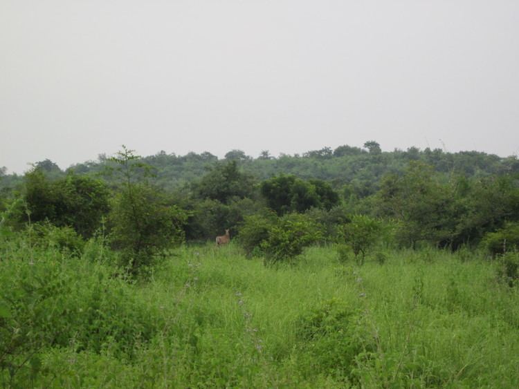
Some geographical locations around Mirzapur district is depicted below
Tourism
For quite some years Mirzapur has been a destination for tourists, particularly for people from adjoining states, owning mainly to the ghats, temples,the famous clock tower(Ghanta Ghar)which are excellent examples of contemporary architecture.
Culture