
Country India Headquarters Allahabad Major highways NH 2 Area 5,482 km² Administrative division Allahabad division | State Uttar Pradesh Tehsils 8 Website Official website Tehsil 8 Lok sabha constituencies Allahabad, Phulpur | |
 | ||
Destinations Allahabad, Shankargarh, Handia, Uttar Pradesh Colleges and Universities University Of Allahabad, Motilal Nehru National I, Sam Higginbottom Institute o, Indian Institute of Informatio, Uttar Pradesh Rajarshi Points of interest Ganges, Khusro Bagh, Yamuna, Allahabad Fort, Jawahar Planetarium | ||
Allahabad District is one of the major & largest districts of Uttar Pradesh state of India, and Allahabad city is the district headquarters. Allahabad district is a part of Allahabad Division. Allahabad District is divided into blocks within tehsils. As of 2011, there are 20 blocks in eight tehsils. The Allahabad division includes the districts of Fatehpur, Kaushambi and Allahabad, with the western Allahabad District becoming part of the new Kaushambi district. The administrative divisions are Phulpur, Koraon, Meja, Sadar, Soraon, Handia, Bara and Karchana.
Contents
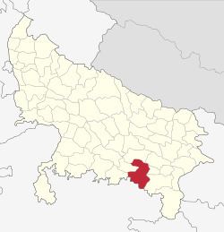
Map of Allahabad, Uttar Pradesh
The three rivers of India - Ganges, Yamuna and the mythical river of Sarasvati - meet at a point in the Allahabad District, known as Sangam, considered holy by Hindus. Allahabad was once the capital of United Province before independence. Allahabad is one of the greatest educational hub having many major educational institutes such as the Indian Institute Of Information Technology, Moti Lal Nehru National Institute Of Technology, University Of Allahabad, CMP Degree College, Ewing Christian College and Gautam Buddh Technical University affiliated number of Engineering Colleges, MotiLal Nehru Medical College, JK Institute - these provides higher education.
Demographics
According to the 2011 census Allahabad District has a population of 5,959,798, roughly equal to the nation of Eritrea or the US state of Missouri. This gives it a ranking of 13th in India (out of a total of 640). As of 2011 it is the most populous district of Uttar Pradesh (out of 71). The district has a population density of 1,087 inhabitants per square kilometre (2,820/sq mi). Its population growth rate over the decade 2001-2011 was 20.74%.
Allahabad District has a sex ratio of 902 females for every 1000 males, and a literacy rate of 74.41% which is close to the all-India average of 74%. This rate is the highest in the region.
Languages
People in the district speak Awadhi, a language in the Hindi continuum spoken by over 38 million people, mainly in the Awadh region; and Bagheli, which has a lexical similarity of 72-91% with Hindi (compared to 60% for German and English) and is spoken by about 7,800,000 people in Bagelkhand.
Religion
Hinduism is majority religion in Allahabad city with 76.03% followers. Islam is second most popular religion in city of Allahabad with approximately 21.94% following it. In Allahabad city, Christianity is followed by 0.68%, Jainism by 0.10%, Sikhism by 0.28% and Buddhism by 0.28%. Around 0.02% stated 'Other Religion', approximately 0.90% stated 'No Particular Religion'. Since the movement of Yeshu Darbar in 1995, UP Mission in 2001 and Yeshu Ashram in 2008 people of various religions attracting towards the teaching of Prabhu Yeshuwa (JESUS CHRIST) and large number of devotees are gathering in this District various places. Allahabad is one of the largest Religious gathering city and Religious Parliament of the world.