
OS grid TQ 912 653 Status complete Phone +44 1795 417850 | Operated by Swale Borough Council, Area 52 ha | |
 | ||
Created 2011 (2011) (Was Church Marshes in 2001) Website Milton Creek Country Park Hours Open today · Open 24 hoursWednesdayOpen 24 hoursThursdayOpen 24 hoursFridayOpen 24 hoursSaturdayOpen 24 hoursSundayOpen 24 hoursMondayOpen 24 hoursTuesdayOpen 24 hoursSuggest an edit Similar Sittingbourne Heritage Museum, Sittingbourne railway station, Central Park Stadium, Kemsley Paper Mill, Sittingbourne and Kemsley | ||
Milton Creek Country Park is situated in 128 acres between Milton Regis and Kemsley in Sittingbourne, Kent, England. This was once called Church Marshes Country Park.
Contents
- Brfm interview milton creek country park february 2011 monday night community show p1
- Geography
- History
- Facilities
- Wildlife
- Park access
- References
Brfm interview milton creek country park february 2011 monday night community show p1
Geography
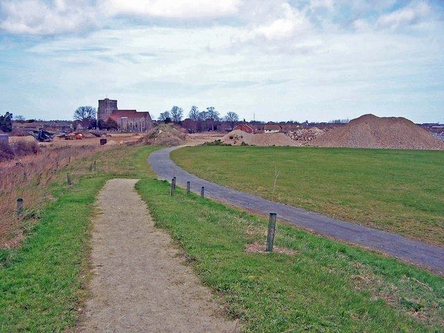
Church Marshes is at the base of Kemsley Down (hills near Kemsley), on the banks of Milton Creek at its estuary with the River Swale, which acts as a boundary with the Isle of Sheppey. It's partly due to these two navigable waters that link directly to the River Thames and its estuary across the English Channel to Europe, that has formed the marshes and nearby locations their rich history. The marshes are named after Holy Trinity Church in Milton Regis. (See Milton Regis for more details on the church).
History
The site of the country park has been used since early times and archaeological evidence has been dated to show that, Saxon and Roman Britain settlements were present in the vicinity. Holy Trinity Church and Castle Roughare the last remaining local historical features.
In the Victorian era, the region was used for barge-building and gravel extraction for brick-making. Barges transported the bricks to London and returned with London’s domestic waste to be buried at the site. Churchfield Wharf, was also formerly the site of a ship breaking company.
The Romani people (Romany)/ traveller community, had formerly a site in the Milton Creek area.
It was a former brick and gravel pit, the area became a landfill site, which closed in 1973. After the site closed, it needed remedial work due to the Environmental Protection Act 1990, so jointly with Swale Council, Groundwork Kent & Medway and Rural Arising Ltd (a firm of engineers and ecologists, who specialise in urban regeneration of landfill sites and other similar industrial sites). Rural Arising Ltd with Groundwork Kent and Medway and Sittingbourne Community College, also provided training and education to a group of 15- and 16-year-olds.
The main purpose of the country park was to create a safe and exciting green space which meets the needs of a predominantly urban population within a countryside setting rich in biodiversity. Groundwork started work in 2001. The project took place over eight phases, and includes; dealing with the Contamination and Landfill Gases, Wildlife Conservation Works Planting of trees, scrubs, pond-side and meadow plants, Construction of paths, picnic/play areas, etc.
When Swale Council started planning for the Sittingbourne Northern Relief Road (SNRR) which passes on the northern boundary of the park near Church Wharf on Milton Creek, they decided to increase the size of the park in 2008 to incorporate the Saxon Shore Way (running along the Milton Creek), which links Sittingbourne town centre to the renamed Milton Creek Country Park. It was renamed in 2009. The path passes through a sequence of viewpoints, one at each of the historic wharves along the creek. Including Grandsdens Wharf, Eastwoods’ Wharf and Church Wharf. The aim of the project is to provide a ‘green heart’ for Sittingbourne.
Creating the park has cost £2.25 million – £2 million of which was Thames Gateway cash awarded via the Homes and Communities Agency. The rest was donated by Kent County Council. Depending on the outcome of the government's spending review next month, Swale Council may be able to apply for more funding that will allow the park to be extended along the coast towards Sheppey.
Groundwork established a Friends of Church Marshes voluntary group, which meets quarterly and a summer fete was held in 2007. They also helped constructing various paths within the park.
Various artist have been commissioned to create various works to promote the country park.
The official opening of the country park was 4 June 2012.
Facilities
As part of the Thames Gateway Parklands development, new footpath surfaces and various artworks have been placed along the Milton Creek on the Saxon Shore Way from Gas Road to the country park.
A new carpark on Saffron Way was finished in 2012.
There is a large community events space and Churchfield Wharf, located next to the new road bridge, provides a 'mini-destination' next to the creek.
The 'sandscape' area has been designed for toddlers and has slides, a bridge and a large seat for parents. The 'marshland' space, has been primarily designed for older children, it features a 7m space-net, reminiscent of the rigging on barges that travelled on the creek. The hill is a place where teenagers can sit.
The large lake within the park is controlled by Kemsley Community Angling Preservation Society (KCAPS) which is a community run club for members and the public. .
Wildlife
Working with Kent Wildlife Trust, the various groups have created ecological habitats for several rare/uncommon creatures, including great crested newt and the shrill carder bee. Other wildlife found within the park included common lizard, Colias (clouded yellow butterfly), glow worms and slow worms.
The land at the northern end of the creek lies within the internationally important Swale Estuary Special Protection Area (SPA), Site of Special Scientific Interest (SSSI) and Ramsar Site.
A small orchard,which was ‘lost’, now being restored as a feature of the park.
Some trees have already been planted in the woodland area – funded by the Forestry Commission.
Known birds visiting the site include ;redshank, black-tailed godwit, teal and grey plover.
Park access
The park can be accessed in various ways, Via;Kemsley Recreation Ground, Grovehurst Road, Newman Drive (as it turns into Recreation Way), Walsby Drive (in the housing estate), Miller Close (in the housing estate), Green Porch Close (by Holy Trinity Church), Gas Road (by CPM - formerly Milton Pipes) and via the Northern Relief Road.
Also, National Cycle Route 1 passes the country park via the B2005, Saffron Way. The Swale Heritage Trail (another long distance local trail) now ends at the park via the Northern Relief Road.