
Area rank 35 in Norway Area 1,861 km² Local time Tuesday 9:07 PM | Demonym(s) GauldalingGauldøl Population 6,012 (2010) | |
 | ||
Weather -1°C, Wind SW at 8 km/h, 74% Humidity | ||
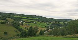
Midtre Gauldal is a municipality in Sør-Trøndelag county, Norway. It is part of the Gauldalen region. The administrative centre of the municipality is the village of Støren. Other villages in the municipality include Singsås, Soknedal, Enodden, and Rognes.
Contents
- Map of Midtre Gauldal Norway
- General information
- Name
- Coat of arms
- Churches
- Geography
- Transportation
- References
Map of Midtre Gauldal, Norway
General information
Midtre Gauldal was established as a new municipality on 1 January 1964 after the merger of the old municipalities of Budal, Singsås, Soknedal, and Støren.
Name
The name Midtre Gauldal was created in 1964. The first element is the Norwegian word Midtre meaning "middle" and the last part is Gauldal which is the name of the valley through which the Gaula River flows. Therefore, the meaning of the name is "the middle part of Gauldalen".
Coat-of-arms
The coat-of-arms is from modern times; they were granted on 17 December 1982. The arms show a silver crossed-Y figure on a green background. The crossed-Y has several meanings. First it symbolizes the landscape which is based on the meeting of the main Gauldal and Soknedal valleys at the village of Støren. Furthermore, the municipality has a major Y-shaped road-and-railway junction. Finally, the Budal Church, dating from 1745 is one of the oldest and one of the few remaining Y-shaped churches in the country.
Churches
The Church of Norway has four parishes (sokn) within the municipality of Midtre Gauldal. It is part of the Deanery (prosti) of Gauldal and the Diocese of Nidaros.
Geography
The municipality is bordered by Meldal and Rennebu to the west, Melhus and Selbu to the north, Holtålen to the east, and Os and Tynset (in Hedmark county) to the south.
The lake Samsjøen is located in the northern part of the municipality. The Gauldalen valley follows the Gaula River through the municipality.
The mountain Forollhogna lies on the southern border of the municipality inside Forollhogna National Park.
Transportation
European route E6 crosses the municipality from north to south. The Dovre Line and Røros Line also cross the municipality. Some of the stations on those lines include Støren Station and Singsås Station.