
Area rank 83 in Norway Area 1,210 km² Local time Monday 7:22 PM | Administrative centre Ålen Demonym(s) Holtåling Population 2,064 (2010) Administrative center Ålen | |
 | ||
Weather -1°C, Wind S at 10 km/h, 77% Humidity | ||
Holtålen is a municipality in Sør-Trøndelag county, Norway. It is part of the Gauldalen region. The administrative centre of the municipality is the village of Ålen. Other villages include Hessdalen, Aunegrenda, Haltdalen, and Renbygda.
Contents
- Map of HoltC3A5len Municipality Norway
- General information
- Name
- Coat of arms
- Churches
- Geography
- References
Map of Holt%C3%A5len Municipality, Norway
General information
The municipality of Holtaalen was established on 1 January 1838 (see formannskapsdistrikt). In 1841, the western part of the municipality was separated to become the municipality of Singsås. This left Holtaalen with 1,885 residents. Then in 1855, the southeastern part of Holtaalen was separated to become the municipality of Ålen, leaving Holtaalen with 809 residents. The spelling of the name was changed to Holtålen in 1921. In 1937, the name was changed from Holtålen to Haltdalen. On 1 January 1972, the municipality of Haltdalen was merged with Ålen to form the new municipality of Holtålen. Prior to the merger, Haltdalen had 778 residents. On 21 April 1989, a small unpopulated part of Røros was transferred to Holtålen.
Name
The Old Norse forms of the name was Holtdalr and (later) Holtáll. The first element is the old name of the Holda river. The last element was (first) dalr which means "valley" or "dale", but this was later (around 1400 AD) replaced by the word áll which means "ditch" or "gully". The form -ålen is the modern finite form of this word. The name of the municipality was spelled Holtaalen before 1938, Haltdalen from 1938 until 1972, and then Holtålen since 1972.
Coat-of-arms
The coat-of-arms is from modern times; they were granted in 1988. The arms show a grouse (Lagopus lagopus) in silver on a red background. It was chosen to reflect the importance of hunting in the municipality.
See also: Coats-of-arms of Lierne and SirdalChurches
The Church of Norway has three parishes (sokn) within the municipality of Holtålen. It is part of the Deanery (prosti) of Gauldal and the Diocese of Nidaros.
Geography
The Gauldalen valley with the Gaula River originates from the mountainous area around the mining town of Røros, about 35 kilometres (22 mi) south of Ålen, and is listed as a World Heritage Site. At the villages of Ålen and Renbygda the deep Gaula valley disappears into the mountains, not far from the lake Riasten.
The western part of Holtålen is where the Forollhogna National Park is located with the mountain Forollhogna on the border with Midtre Gauldal. The lake Øyungen lies just outside the park.
The Kjøli and Killingdal copper mines are located in the southeastern part of Holtålen. The last mine in production was Killingdal until it closed down in 1986.
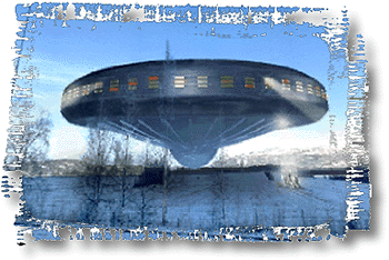
Hessdalen is a mountain valley joining the Gauldal valley close to the village of Ålen. Around 1983, Hessdalen became famous for UFO observations and the Hessdalen lights. Because of this the Hessdalen AMS station was founded in the valley.
The Rørosbanen railway line runs through the municipality with the Ålen Station and Haltdalen Station as stops along the way.