
Elevation 1,300 m | Time zone EAT (UTC+3) Local time Thursday 2:13 PM | |
 | ||
Weather 23°C, Wind S at 18 km/h, 88% Humidity Restaurants Zone 7, Mama Emmy Restaurant, PTA Bar and Restaurant, Andres Restaurant and Bar Hotels Enkombe Place Hotel, CityBlue Hotel & Suites Ka, Materwood Hotel | ||
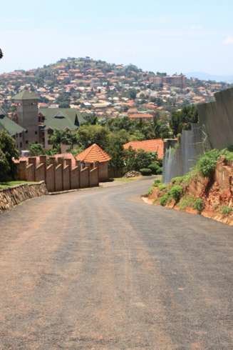
Driving kampala garden city to mbuya
Mbuya is a hill in southeastern Kampala, the capital city of Uganda. The hill rises 1,300 metres (4,300 ft) above sea level. The name also applies to the upscale residential neighborhood that sits on that hill, as well as the government military installations located there.
Contents
- Driving kampala garden city to mbuya
- Map of Mbuya Kampala Uganda
- African corner tv mbuya kinawataka kampala uganda mov
- Location
- History
- Notable residents
- Points of interest
- References
Map of Mbuya, Kampala, Uganda
African corner tv mbuya kinawataka kampala uganda mov
Location
Mbuya is located in Nakawa Division, one of the five administrative divisions of Kampala. It is bordered by Kyambogo to the north, Kinawataka and Kireka to the northeast, Butabika and Biina to the east, Mutungo to the southeast, Port Bell, Kitintale and Bugoloobi to the south, Namuwongo to the southwest, Nakawa to the west and Ntinda to the northwest. This location lies approximately 10 kilometres (6.2 mi), by road, east of Kampala's central business district. The coordinates of Mbuya are: 0°19'39.0"N, 32°37'48.0"E (Latitude: 0.3275; Longitude: 32.6300).
History
Before Europeans came to Uganda, Mbuya was the seat of Kaggo, a Luganda word meaning whip. Kaggo is the title of the County Chief of Kyaddondo, then one of the 20 counties of Buganda. Today Kyaddondo surrounds Kampala to the north and east and includes most of present-day Kampala. The county headquarters were eventually moved to Kasangati and Mbuya was converted into an upscale residential and commercial area.
Notable residents
Points of interest
The following points of interest are located in Mbuya: