
Mountain type Complex volcano Prominence 2,745 m | Elevation 2,745 m Mountain range Big Ben | |
 | ||
Isolation 1,922 kilometres (1,194 mi) Listing Country high pointUltra Similar Mount Augustus - Western, Mount Kosciuszko, Mount Townsend, McDonald Islands, Bimberi Peak | ||
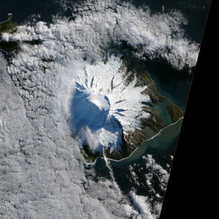
Mawson Peak is an active volcanic mountain on Heard Island, an external Australian territory in the Southern Ocean.
Contents
Map of Mawson Peak, Heard Island and McDonald Islands
With its summit at 2,745 metres (9,006 ft), it is the third highest peak in any state or territory of Australia, higher than the 2,228-metre (7,310 ft) Mount Kosciuszko, and surpassed only by the 3,490-metre (11,450 ft) Mount McClintock and the 3,355-metre (11,007 ft) Mount Menzies in the Australian Antarctic Territory. An active complex volcano which erupted as recently as April 2013 and February 2016, Mawson Peak is the summit of the Big Ben massif.
Discovery and naming
Mawson Peak was named by the 1948 ANARE Heard Island Expedition after the Australian geologist and explorer Sir Douglas Mawson, the leader of BANZARE 1929-31, who visited the island in November – December 1929.
On the 20th February 1950, whilst aboard HMAS Lebuan, Thomas Gratton (Tim) Young OAM observed and recorded in the ship's log that Mawson Peak was an active volcano.
The 1964-65 expedition to Heard Island was led by Major Warwick Deacock, with the schooner Patanela skippered by Major Bill Tilman. They succeeded in climbing Mawson Peak for the first time, which is the highest point on this remote island.