
 | ||
Country Heard Island and McDonald Islands | ||
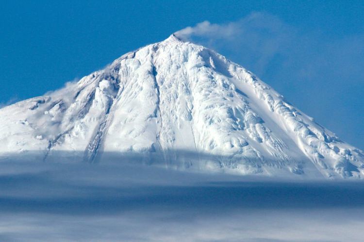
Big Ben is a volcanic massif that dominates the geography of Heard Island in the southern Indian Ocean. It is a composite cone with a diameter of approximately 25 kilometres. Its highest peak is Mawson Peak, which is 2,745 m above sea level. Much of it is covered by ice, including 14 major glaciers which descend from Big Ben to the sea. Big Ben is the highest mountain in Australian Territory, except for those in the Australian Antarctic Territory. A smaller volcanic headland, the Laurens Peninsula, extends approximately 10 km to the northwest, created by a separate volcano, Mount Dixon; its highest point is Anzac Peak, at 715 m.
Contents
Map of Big Ben, Heard Island and McDonald Islands
Volcanic activity
Volcanic activity at the cone has been known since 1881. An eruption occurred in 1993. Satellite images detected eruptions during 2000. On 2 February 2001, observations from Atlas Cove, 15 km NW of Mawson Peak, showed plumes up to 1 km high over the volcano. Satellite images showed hotspots at various times from 2003 to 2008, and during September 2012. A further eruption was reported on 2 February 2016, and was recorded by scientists who happened to be in the area on an expedition. Big Ben does not endanger humans because Heard Island is uninhabited.