
Website www.co.maui.hi.us Founded 1905 | Area 6,213 km² Population 160,202 (2013) Unemployment rate 4.1% (Apr 2015) | |
 | ||
Points of interest | ||
Maui County, officially County of Maui, is a county located in the U.S. state of Hawaii. It consists of the islands of Maui, Lanai, Molokai (except for a portion of Molokai that comprises Kalawao County), Kahoolawe, and Molokini. The latter two islands are uninhabited. As of the 2010 census, the population was 154,834. The county seat is Wailuku.
Contents
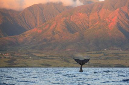
- Map of Maui County HI USA
- Government
- Geography
- Adjacent counties
- National protected areas
- Demographics
- Top employers
- Transportation
- Major Highways
- Unincorporated communities
- Sister cities
- References
Map of Maui County, HI, USA
Maui County is included in the Kahului-Wailuku-Lahaina, HI Metropolitan Statistical Area.
Government
Maui County has a quasi-mayor-council form of municipal government. Unlike traditional municipal governments, the county government is established by the state legislature by statute and is not chartered. Executive authority is vested in the mayor, elected by the voters on a non-partisan basis to a four-year term (with a limit of two consecutive full terms). Legislative authority is vested in the nine-member county council. All seats in the county council have residency requirements; however, all voters in Maui County may vote in elections for all nine seats regardless of residence. Members of the county council are elected on a non-partisan basis to two-year terms (with a limit of five consecutive full terms).
The current mayor of Maui County is Alan Arakawa since January 2, 2011. Arakawa had served a previous term as mayor from 2002 to 2006.
Maui County was the only county in the United States won by Dennis Kucinich during his unsuccessful campaign for the Democratic Party nomination to the presidency in 2004.
The Department of Liquor Control is the agency which regulates and enforces state and county laws regarding the manufacture, importation, sale and consumption of intoxicating liquors.
Geography
According to the U.S. Census Bureau, the county has a total area of 2,398 square miles (6,210 km2), of which 1,162 square miles (3,010 km2) is land and 1,237 square miles (3,200 km2) (51.6%) is water. The islands that comprise Maui County correspond to the remnants of the ancient landmass of Maui Nui. The highest point in the county is the peak of Haleakala at 10,012 ft. Haleakala is a shield volcano located on the eastern side of the island of Maui.
Adjacent counties
National protected areas
Demographics
As of the 2000 Census, there were 128,094 people, 43,507 households, and 29,889 families residing in the county. The population density was 110 people per square mile (43/km²). There were 56,377 housing units at an average density of 49 per square mile (19/km²). The racial makeup of the county was 28.90% White, 1.40% Black or African American, 0.37% Native American, 33.01% Asian, 10.72% Pacific Islander, 1.36% from other races, and 22.24% from two or more races. 7.8% of the population were Hispanic or Latino of any race.
There were 43,507 households out of which 33.00% had children under the age of 18 living with them, 50.90% were married couples living together, 12.00% had a female householder with no husband present, and 31.30% were non-families. 21.90% of all households were made up of individuals and 6.30% had someone living alone who was 65 years of age or older. The average household size was 2.91 and the average family size was 3.41.
In the county, the population was spread out with 25.50% under the age of 18, 7.70% from 18 to 24, 30.90% from 25 to 44, 24.40% from 45 to 64, and 11.40% who were 65 years of age or older. The median age was 37 years. For every 100 females there were 100.90 males. For every 100 females age 18 and over, there were 100.20 males.
Top employers
According to the County's 2011 Comprehensive Annual Financial Report, the top employers in the county are:
Transportation
Two airports provide scheduled air service to the island of Maui:
Lanai Airport provides service for Lanai. Molokai Airport, also in Maui County, provides service for Molokai.
Major Highways
Unincorporated communities
Sister cities
Maui County currently has 21 sister cities, including: