
Length 51.89 km | ||
 | ||
Counties Norfolk County, Massachusetts, Plymouth County, Massachusetts | ||
Route 139 is nominally a west–east state highway in southeastern Massachusetts.
Contents
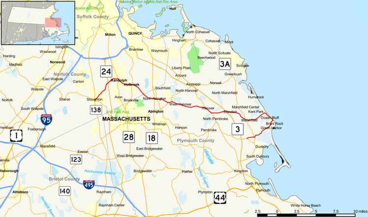
Map of MA-139, Massachusetts, USA
Route description
Route 139 begins in Stoughton Square at the southern junction of the Route 27 and 138 concurrency. The highway heads northeast until the junction with Route 24, at which point the highway heads almost due east. After the brief concurrency with Route 28 in Randolph, the highway heads in a generally east-southeasterly direction through Holbrook, the extreme southwest corner of Weymouth, the North Abington section of Abington, Rockland, Hanover, the northern edge of Pembroke, and Marshfield.
Once the highway reaches the shoreline in Marshfield, it turns in a south-southeasterly direction, passing through Fieldston, Ocean Bluff and Brant Rock, proceeding until just north of Brant Rock's esplanade. But then the highway heads west, while still signed east, for the last 4.5 miles (7.2 km), passing through Green Harbor before ending at Route 14 in Duxbury.