
Country United States Incorporated 1727 Area 40.7 km² Population 13,164 (2000) | State Massachusetts Settled 1649 Elevation 60 ft (18 m) Zip code 02339 Local time Wednesday 9:37 PM | |
 | ||
Weather -5°C, Wind W at 18 km/h, 55% Humidity | ||
Hanover is a town in Plymouth County, Massachusetts, United States. The population was 13,879 at the 2010 census.
Contents
- Map of Hanover MA USA
- History
- Geography
- Demographics
- Government
- Education
- Notable people
- Transportation
- References
Map of Hanover, MA, USA
History
The area of Hanover was first settled by English settlers in 1649 when William Barstow, a farmer, built a bridge along the North River at what is now Washington Street. The land was the westernmost portion of the town of Scituate, and it would officially separate and be incorporated as a town June 14, 1727. The name "Hanover" is probably a tribute to King George I, the first Hanoverian King of Great Britain. (While George I died on June 11, 1727, the reports would not have reached the colonies until after the town's incorporation.) Hanover's early industry revolved around farming, small mills and a shipbuilding area along the North River. Later industries would include tack factories and shoe factories along the smaller waterways in the town. The town was the site of the invention of the first tack-making machine, and making tacks and fireworks were among the industries of the later 19th century for Hanover. Today, Hanover is mostly residential. The Hanover Mall and other shops are located near the intersection of Routes 3 and 53. In 2007 Hanover American Legion Post 149 baseball team won the state title. In the Summer of 2012 - Hanover became home to the New England Football League (NEFL)'s newest expansion, Semi-Professional Football Team - The South Shore Chiefs. Home games are played at Hanover High School.
Geography
According to the United States Census Bureau, the town has a total area of 15.7 square miles (41 km2), of which 15.6 square miles (40 km2) is land and 0.1 square miles (0.26 km2), or 0.70%, is water. Hanover is the 240th town in terms of size in Massachusetts. Hanover is considered to be a part of the South Shore of Massachusetts. It is bordered by Norwell to the north and east, Pembroke and Hanson to the south, and Rockland to the west and northwest. Hanover is approximately 10 miles (16 km) east of Brockton and 20 miles (32 km) southeast of Boston.
Much of Hanover's eastern and southern borders consist of three waterways, the North and Indian Head rivers along the south and southeast, and the Third Herring Brook along the east. (The latter two are both tributaries, and the town border is marked by their confluences.) There are also several small ponds and brooks throughout the town, the largest pond being Factory Pond, a tributary of the Indian Head River in the south of town. The town has several small parks, sanctuaries and conservation areas spread throughout the town.
Demographics
As of the census of 2000, there were 13,164 people, 4,349 households, and 3,566 families residing in the town. The population density was 843.4 people per square mile (325.6/km²). There were 4,445 housing units at an average density of 284.8 per square mile (109.9/km²). The racial makeup of the town was 97.68% White, 0.55% African American, 0.08% Native American, 0.77% Asian, 0.01% Pacific Islander, 0.27% from other races, and 0.65% from two or more races. Hispanic or Latino of any race were 0.68% of the population.
There were 4,350 households out of which 43.8% had children under the age of 18 living with them, 70.8% were married couples living together, 8.0% had a female householder with no husband present, and 18.0% were non-families. 15.2% of all households were made up of individuals and 8.8% have someone living alone who is 65 years of age or older. The average household size was 3.02 and the average family size was 3.39.
In the town, the population was spread out with 29.8% under the age of 18, 5.6% from 18 to 24, 28.8% from 25 to 44, 25.3% from 45 to 64, and 10.5% who were 65 years of age or older. The median age was 38 years. For every 100 females there were 95.9 males. For every 100 females age 18 and over, there were 91.3 males.
The median income for a household in the town was $73,838, and the median income for a family was $86,835. Males had a median income of $57,321 versus $35,214 for females. The per capita income for the town was $30,268. About 1.4% of families and 2.3% of the population were below the poverty line, including 1.6% of those under age 18 and 7.8% of those age 65 or over.
Government
On the national level, Hanover is a part of Massachusetts's 9th congressional district, and is currently represented by William R. Keating. The state's senior (Class I) member of the United States Senate, elected in 2012, is Elizabeth Warren. The junior (Class II) senator, elected in a special election in 2013, is Ed Markey.
On the state level, Hanover is represented in the Massachusetts House of Representatives as a part of the Fifth Plymouth district, which includes the neighboring towns of Norwell and Rockland. The town is represented in the Massachusetts Senate as a part of the Second Plymouth and Bristol district, which includes Brockton, Halifax, Hanson, Whitman and portions of East Bridgewater and Easton. The town is patrolled on a secondary basis by the First Barracks of Troop D of the Massachusetts State Police, located in Norwell.
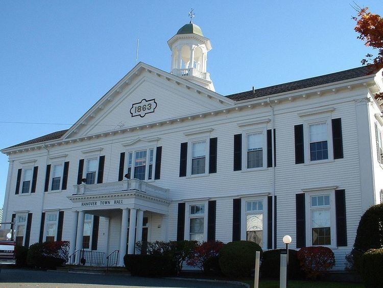
Hanover is governed by the open town meeting form of government, and is led a board of selectmen. The town has its own police and fire departments, with active firehouses in Center Hanover and West Hanover. The fire department operates the ambulance service, with the nearest hospitals being Brockton Hospital and South Shore Hospital in Weymouth. There are two post offices located in town, near Hanover Four Corners and West Hanover, both along Route 139. The town is home to the John Curtis Free Library, which was founded with the help of its namesake in the 1800s. The library is a part of the Old Colony Library Network. Hanover is also the site of a YMCA, near the mall.
Education
Hanover operates its own school system for the town's approximately 2,700 students. There are three elementary schools, the Cedar, Center and Sylvester Elementary Schools. The Center School serves students from pre-kindergarten through second grade, the Sylvester School (located around the corner from the Center School, both at Hanover Center) serves third and fourth grade students, and the Cedar Elementary School (located next to the high school) serves from pre-kindergarten through fourth grade. The Hanover Middle School serves students from fifth through eighth grade, and Hanover High School serves students from ninth through twelfth grade. Hanover High's teams are nicknamed the Indians, and their colors are blue and gold. Hanover competes in the Patriot League, and their chief rival is Norwell. Hanover finished building its new high school in 2012; the graduating class of 2012 will be the first to graduate from the school and the second class to graduate on the new turf field.
Hanover is also the home of the South Shore Vocational Technical High School, which serves the vocational needs of the surrounding communities. There are no private schools in the town; there are, however, schools in the surrounding communities. The nearest colleges are Massasoit Community College in Brockton, and Bridgewater State University.
Notable people
Transportation
A short, three-mile portion of Massachusetts Route 3, a four-lane freeway, passes through the town, providing access via an exit at Route 53 in the northeast corner of town. The town's other major routes include Route 123 and Route 139, the latter passing through the town center. Routes 139 and 53 are coextensive for a stretch of one mile in the southeast corner of town.
The town has no rail or air service, though the town used to have rail service on the Hanover branch. The nearest rail service is the Kingston-Route 3 line of the MBTA's commuter rail service, which passes west of town, the closest stations being in Abington and Whitman. The nearest regional airport is Marshfield Municipal Airport, and the nearest national and international service can be reached at Logan International Airport in Boston. Seaplanes occasionally land in neighboring Hanson, on Lake Monponsett.