
Length 90.1 km | ||
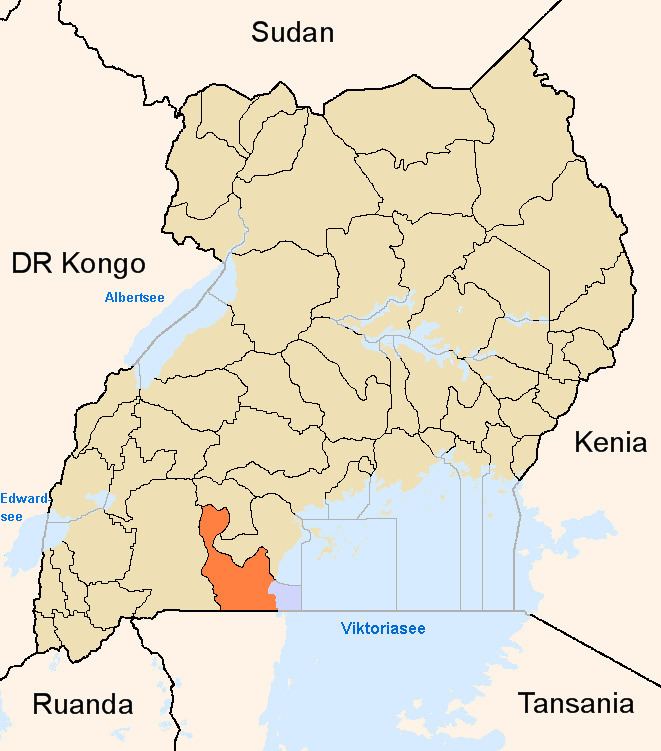 | ||
The Masaka–Mutukula Road is a road in the Central Region of Uganda, connecting the town of Masaka, in Masaka District, to the border town of Mutukula in Rakai District.
Contents
Location
The road stars in Masaka, near the Uganda Police barracks, where this road forms a T-junction with Broadway Road. The road continues in a southwesterly direction, through Kalisizo, Kyotera and ends in Mutukula, at the international border with Tanzania, a total length of about 90 kilometres (56 mi).
Overview
This road is part of the East African Community Road Network Project. It is the main road transport corridor between Uganda and Tanzania. The road is divided into two sections: (a) Masaka–Kyotera section, which measures 44 kilometres (27 mi), was built in 1960s and has begun to deteriorate and (b) Kyotera–Mutukula section, measuring 46 kilometres (29 mi), was originally constructed in the 1960’s and was upgraded to class II bitumen standards in 2003 with a loan from the African Development Bank. Section (b) was in good condition, as of 2006, while section (a) was in need of an upgrade.