
- land 8.1 sq mi (21 km) Area 22.27 km² | - summer (DST) CDT (UTC-5) Area code 504 | |
 | ||
- water 0.5 sq mi (1 km), 5.81% Parish | ||
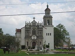
Marrero is a census-designated place (CDP) in Jefferson Parish, Louisiana, United States. Marrero is on the West Bank of the Mississippi River, within the New Orleans–Metairie–Kenner Metropolitan Statistical Area. The population was 36,165 at the 2010 census.
Contents
Map of Marrero, LA 70072, USA
History
Marrero was named in honor of Louisiana politician and founder of Marrero Land Company, Louis H. Marrero.
Louis Herman Marrero was born in Adams County, Mississippi, on July 17, 1847. When he was a child his family moved to St. Bernard Parish, Louisiana.
During his school years at Jackson, Louisiana, the American Civil War began and Marrero joined Captain Scott's Command, later known as the 25th Louisiana Regiment.
Geography
Marrero is located west of the Intracoastal Canal on the Mississippi River, at coordinates 29°53′10″N 90°6′36″W (29.886017, -90.109930).
According to the United States Census Bureau, the CDP has a total area of 8.6 square miles (22.2 km²), of which, 8.1 sq mi (21 km2) of it is land, and 0.5 sq mi (1.3 km2) of it (5.96%) is water.
Demographics
As of the census of 2010, there were 33,141 people, 12,432 households, and 9,336 families residing in the CDP. The population density was 4,091.5 people per square mile (1,734.6/km²). There were 13,046 housing units at an average density of 1,620.9 per square mile (625.7/km²). The racial makeup of the CDP was 40.68% White, 45.80% African American, 0.68% Native American, 6.34% Asian, 0.15% Pacific Islander, 1.08% from other races, and 1.22% from two or more races. Hispanic or Latino of any race were 6.82% of the population.
There were 12,432 households out of which 35.3% had children under the age of 18 living with them, 46.4% were married couples living together, 23.4% had a female householder with no husband present, and 24.9% were non-families. 21.3% of all households were made up of individuals and 9.2% had someone living alone who was 65 years of age or older. The average household size was 2.86 and the average family size was 3.33.
In the CDP, the population was spread out with 29.0% under the age of 18, 9.5% from 18 to 24, 27.5% from 25 to 44, 22.2% from 45 to 64, and 11.7% who were 65 years of age or older. The median age was 34 years. For every 100 females there were 87.1 males. For every 100 females age 18 and over, there were 81.3 males.
The median income for a household in the CDP was $31,648, and the median income for a family was $37,287. Males had a median income of $31,995 versus $20,501 for females. The per capita income for the CDP was $13,933. About 16.3% of families and 20.9% of the population were below the poverty line, including 31.2% of those under age 18 and 15.7% of those age 65 or over.
Education
Marrero's public schools are operated by the Jefferson Parish Public School System.
High Schools:
L.H. Marrero Middle School is in Marrero. Parts of Marrero are zoned to Worley Middle in Westwego, Louisiana and Truman Middle in Estelle.
Elementary schools in Marrero include:
Schools outside of Marrero serving portions include Vic A. Pitre Elementary School in Westwego, Estelle Elementary in Estelle.
In regards to advanced studies academies, some residents are zoned to the Marrero Academy and some are zoned to the Gretna Academy.
The Roman Catholic Archdiocese of New Orleans operates two high schools:
Jefferson Parish Library operates the Belle Terre Library in Marrero.