
- land 15.1 sq mi (39 km) - Reincorporated April 1, 1873 - summer (DST) CDT (UTC-5) Population 66,975 (2013) | - Incorporated 1867 - Reincorporated December 13, 1913 Local time Saturday 9:30 PM | |
 | ||
- water 0.1 sq mi (0 km), 0.66% Weather 19°C, Wind E at 11 km/h, 88% Humidity Points of interest Treasure Chest Casino, Laketown, Veterans Park, Seton Park | ||
Kenner (historically French: Cannes-Brûlées) is the sixth-largest city in the U.S. State of Louisiana. It is the largest city in Jefferson Parish, United States, Louisiana's second-most populous parish, and a suburb of New Orleans. The population was 66,702 at the 2010 census.
Contents
- Map of Kenner LA USA
- Crowne plaza new orleans airport kenner louisiana
- History
- Geography
- Demographics
- Ethnic groups
- Places of interest
- Government and infrastructure
- Economy
- Primary and secondary schools
- Library and planetarium
- Media
- Buses
- Roads
- Airport
- References
Map of Kenner, LA, USA
Kenner is represented in the Louisiana House of Representatives by the Republican attorney Tom Willmott. The state senator is Republican Danny Martiny, a former state House member. Martiny's predecessor in the House is Kernan "Skip" Hand, a retired district court judge from Kenner. Martiny's predecessor in the state Senate, Metairie attorney Art Lentini, also resides in Kenner. Kenner is part of Louisiana's 1st Congressional district, presently represented in the U.S. House by Steve Scalise. The current mayor of Kenner is former Jefferson Parish councilman Ben Zahn.
Crowne plaza new orleans airport kenner louisiana
History
Originally inhabited by the Tchoupitoulas Indians, the area along the Mississippi River was the first land in the New Orleans Metropolitan Area on which Europeans set foot. René-Robert Cavelier, Sieur de La Salle landed there in 1682. In 1855, Kenner was founded by Minor Kenner on land that consisted of three plantation properties that had been purchased by the Kenner family. At the time, all land north of what is now Airline Highway was swampland.
In Kenner on May 10, 1870, “Gypsy” Jem Mace defeated Tom Allen for the heavyweight championship of the bare-knuckle boxing era; a monument marks the spot near the river end of Williams Boulevard.
During 1915–1931 a New Orleans streetcar line operated between New Orleans and Kenner. The line ran between the intersection of Rampart and Canal in New Orleans and the intersection of Williams Blvd and Jefferson Hwy in Kenner.
In 1960, Kenner had a population of 17,037.
Kenner's growth began in the late 1950s when developers began subdividing, draining and filling the swampland in the northern half of the city. During the 1960s, the construction of Interstate 10 and improvements to Veterans Memorial Highway aided the rapid development of Kenner as a suburb of New Orleans.
By 1979, Kenner's population was 60,524 making it the 6th largest city in the state.
In 1982, Pan Am Flight 759 crashed in a residential area of Kenner when a microburst forced it down. 8 people on the ground were killed, as were all 145 people on the aircraft. Six houses were completely destroyed and five more substantially damaged.
Geography
Kenner's coordinates are 30°0′35″N 90°15′2″W (30.009610, −90.250585) and has an elevation of 0 ft (0 m).
According to the United States Census Bureau, the city has a total area of 15.2 square miles (39 km2), of which, 15.1 square miles (39 km2) of it is land and 0.1 square miles (0.26 km2) of it (00.7%) is water.
Kenner is located on the west side of the New Orleans Metropolitan Area, in Jefferson Parish. Its boundaries are Lake Pontchartrain to the north; the Mississippi River to the south; the unincorporated areas of Metairie and River Ridge to the east; and St. Charles Parish to the west.
Demographics
As of the Census QuickFacts survey of 2013, there were 66,975 living in Kenner, down from 70,517 people in 2000. The population density was 4,486.0 people per square mile. There were 28,076 housing units. The racial makeup of the city was 48.8% White, 24.0% African American, 22.4% Hispanic or Latino, 0.4% Native American, 3.7% Asian, 3.80% from other races, and 2.24% from two or more races.
There were 25,652 households out of which 36.3% had children under the age of 18 living with them, 50.9% were married couples living together, 16.3% had a female householder with no husband present, and 28.0% were non-families. 23.2% of all households were made up of individuals and 6.1% had someone living alone who was 65 years of age or older. The average household size was 2.72 and the average family size was 3.23.
In the city, the population was spread out with 27.3% under the age of 18, 9.4% from 18 to 24, 30.5% from 25 to 44, 23.9% from 45 to 64, and 8.9% who were 65 years of age or older. The median age was 34 years. For every 100 females there were 92.5 males. For every 100 females age 18 and over, there were 88.4 males.
The median income for a household in the city was $39,946, and the median income for a family was $45,866. Males had a median income of $34,964 versus $24,051 for females. The per capita income for the city was $19,615. About 11.0% of families and 13.6% of the population were below the poverty line, including 18.7% of those under the age of 18 and 12.0% of those 65 and older.
According to Census 2000, Kenner had 32 houses valued at $1,000,000 or more.
Ethnic groups
As of 2010 Hispanics and Latinos are 22% of Kenner's population and of the 20 U.S. Census Bureau tracts in Kenner, 12 of them have Hispanic populations of 15% or more: one of those census tracts has the highest number of Hispanic and Latino people in all of Louisiana. By 2011 many business catering to Hispanics and Latinos had opened in Kenner. In 2000 Hispanics were 14% of Kenner's population and six census tracts had greater than 15% Hispanic populations.
A portion of north Kenner is called "Little Honduras." Kenner's Hispanic Resource Center offers English as a second language classes and after school programs.
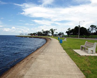
Places of interest
Kenner is home to the following:
Government and infrastructure
The United States Postal Service operates two post offices. They are the Kenner Post Office and the North Kenner Post Office.
Economy
At one time L'Express Airlines had its headquarters in Kenner.
Primary and secondary schools
Kenner is served by the Jefferson Parish Public School System.
The only high school in Kenner is Alfred Bonnabel High School, which is located on the border between Metairie and Kenner. Most areas are zoned to Bonnabel. Some areas are zoned to East Jefferson High School and Grace King High School, both in Metairie. Theodore Roosevelt Middle School [1] is the sole middle school in Kenner. In addition to Roosevelt, middle schools serving sections of Kenner include Adams Middle and Harris Middle in Metairie and Riverdale Middle in Jefferson.
Elementary Schools include:
In regards to the advanced studies academies, students are zoned to Airline Park Academy.
Faith-based, Private, and Preparatory Schools Include:
Library and planetarium
Jefferson Parish Library operates the North Kenner Library.
Kenner also has the Louis J. Roussel, Jr., Laser Planetarium, named for the New Orleans businessman and political kingmaker Louis J. Roussel, Jr..
Media
The Kenner Star is Kenner's free monthly community newspaper.
Kenner is served primarily by New Orleans-based media outlets. (See Media of New Orleans)
Buses
Public transportation in the city is operated by The Jefferson Parish Department of Transit Administration which operates Jefferson Transit. Jefferson Transit provides service to points in Kenner, Metairie and New Orleans as well as other locations in incorporated and unincorporated Jefferson Parish.
Roads
Kenner is served by Interstate 10 which travels east–west through the city. Traveling westbound from the city line there are exits at Power Blvd., LA 49 (Williams Blvd.)/32nd St. - New Orleans Int'l Airport, and Loyola Dr.
In addition the interstate, U.S. 61 (generally signed as Airline Dr.) travels east–west through the southern end of the city. LA 49 (signed as Williams Blvd.) is the city's primary north–south corridor.
Airport
Louis Armstrong New Orleans International Airport (IATA: MSY), the main commercial airport for the New Orleans metropolitan area, is located within the city limits, just south of Interstate 10. It serves as a major tax-revenue generator for the city.