
Listing Ultra First ascent 13 September 1984 | Elevation 7,516 m Prominence 1,803 m | |
 | ||
First ascenders H. Chauhan, N. Yamada, P. Das, K. Yoshida, R. Sharma Similar Rimo I, Saltoro Kangri, Apsarasas Kangri, Distaghil Sar, Yutmaru Sar | ||
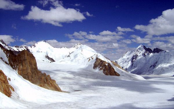
Mamostong Kangri or Mamostang Kangri is the highest peak in the remote Rimo Muztagh, a subrange of the Karakoram range in Jammu and Kashmir state of India near its border with China. It is located about 30 km east-southeast of the snout of the Siachen Glacier. It is the 48th highest independent peak in the world (using a 500m prominence cutoff).
Map of Mamostong Kangri, 194401
The South Chong Kumdan Glacier, Kichik Kumdan (Thangman), Mamostong, and South Terong Glaciers all head on the slopes of Mamostong Kangri.
Mamostong Kangri has not seen a great deal of visitation due to its remote location and the unsettled political and military situation in the region. The first European exploration of the peak was in 1907 by Arthur Neve and D. G. Oliver. The first ascent was made in 1984 by an Indo-Japanese expedition, via the Northeast Ridge, after a complicated approach. The summit party comprised N. Yamada, K. Yoshida, R. Sharma, P. Das, and H. Chauhan.
The Himalayan Index lists four additional ascents of this peak; however two of these listings may be for the same climb.