
Easiest route snow/ice climb First ascent 1976 Parent peak Teram Kangri | Elevation 7,245 m Prominence 635 m | |
 | ||
Similar Yutmaru Sar, Lupghar Sar, Mamostong Kangri, Skil Brum, Kangpenqing | ||
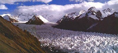
Apsarasas Kangri is a mountain in the Siachen Karakoram range. With an elevation of 7,245 m (23,770 ft) it is the 96th highest mountain in the world. Apsarasas Kangri is located on the border between Xinjiang, China and the Siachen Glacier region, controlled by India and claimed by Pakistan.
Map of Apsarasas Kangri I
The peak was first climbed in 1976. In 1988, an Indian army team climbed the Apsaras I peak. Apsaras II and Apsaras III are listed as "virgin peaks" by Indian Mountaineering Foundation.
References
Apsarasas Kangri Wikipedia(Text) CC BY-SA