
Total islands 25,000 Largest settlement Flying Fish Cove Area 2 million km² | Province Bangka-Belitung Islands | |
 | ||
Islands Points of interest Lake Toba, Gunung Mulu National, Borobudur, Prambanan, Gunung Gede Pangrang | ||
The Malay Archipelago (Malaysian: Kepulauan Melayu, Indonesian: Kepulauan Melayu/Nusantara, Tagalog: Kapuluang Malay, Visayan: Kapupud-ang Malay) is the archipelago between mainland Indochina and Australia. It has also been called the Malay World, Indo-Australian Archipelago, East Indies, Nusantara, Spices Archipelago, and other names over time. The name was taken from the 19th-century European concept of a Malay race.
Contents
- Map of Malay Archipelago Jangkang East Belitung Regency Bangka Belitung Indonesia
- Pre islamic malay archipelago
- Etymology and terminology
- Geography
- Biogeography
- Demography
- References
Map of Malay Archipelago, Jangkang, East Belitung Regency, Bangka-Belitung, Indonesia
Situated between the Indian and Pacific Oceans, the group of over 25,000 islands is the largest archipelago by area, and fourth by number of islands in the world. It includes Brunei, East Malaysia, East Timor, Indonesia, Singapore and Philippines. The island of New Guinea is usually excluded from definitions of the Malay Archipelago, although the Indonesian western portion of the island may be included. The term is largely synonymous with maritime Southeast Asia.
Pre islamic malay archipelago
Etymology and terminology
The term was derived from the European concept of a Malay race, which referred to the people who inhabited what is now Brunei, East Timor, Indonesia (excluding Western New Guinea), Malaysia, Singapore and Philippines. The racial concept was proposed by European explorers based on their observations of the influence of the ethnic Malay empire, Srivijaya, which was based on the island of Sumatra, Indonesia.
The 19th-century naturalist Alfred Wallace used the term "Malay Archipelago" as the title of his influential book documenting his studies in the region. Wallace also referred to the area as the "Indian Archipelago" and the "Indo-Australian" Archipelago. He included within the region the Solomon Islands and the Malay Peninsula due to physiographic similarities. As Wallace noted, there are arguments for excluding Papua New Guinea for cultural and geographical reasons: Papua New Guinea is culturally quite different from the other countries in the region, and the island of New Guinea is geologically not part of the continent of Asia, as the islands of the Sunda Shelf are (see Australia).
The archipelago was called the "East Indies" from the late 16th century and throughout the European colonial era. It is still sometimes referred to as such, but broader usages of the "East Indies" term had included Indochina and the Indian subcontinent. The area is called "Nusantara" in the Indonesian language. The area is also referred to as the "Indonesian archipelago". The term "maritime Southeast Asia" is largely synonymous, covering both the islands in Southeast Asia and nearby island-like communities, such as those found on the Malay Peninsula.
Geography
The land and sea area of the archipelago exceeds 2 million km2. The more than 25,000 islands of the archipelago comprise many smaller archipelagoes.
The major groupings are:
The six largest islands are New Guinea, Borneo, Sumatra, Sulawesi, and Java in Indonesia; and Luzon in the Philippines.
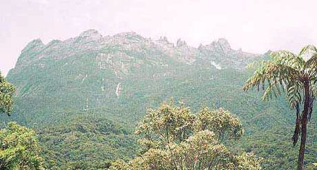
Geologically the archipelago is one of the most active volcanic regions in the world. Tectonic uplifts have produced large mountains, including the highest in Mount Kinabalu in Sabah, Malaysia, with a height of 4,095.2 m and Puncak Jaya on Papua, Indonesia at 4,884 m (16,024 ft). Other high mountains in the archipelago include Puncak Mandala, Indonesia at 4,760 m (15,617 ft) and Puncak Trikora, Indonesia, at 4,750 m (15,584 ft).
The climate throughout the archipelago is tropical, owing to its position on the equator.
Biogeography
Wallace used the term Malay Archipelago as the title of his influential book documenting his studies in the region. He proposed what would come to be known as the "Wallace Line", a boundary that separated the flora and fauna of Asia and Australia. The ice age boundary was formed by the deep water straits between Borneo and Sulawesi; and through the Lombok Strait between Bali and Lombok. This is now considered the western border of the Wallacea transition zone between the zoogeographical regions of Asia and Australia. The zone has a mixture of species of Asian and Australian origin, and its own endemic species.
Demography
Over 380 million people live in the region, with the most populated islands being Java (140 million), Luzon (53 million), Sumatra (50 million), Taiwan (23 million), Mindanao (22 million) and Sri Lanka (20 million).
The people living there are predominantly from Austronesian subgroupings and correspondingly speak western Malayo-Polynesian languages. The main religions in this region are Islam, Christianity, Buddhism, Hinduism, and traditional animism.
Culturally, the region is often seen as part of "Farther India" or Greater India—the Coedes Indianized states of Southeast Asia refers to it as "Island Southeast Asia".