
Founded 1823 Area 1,173 km² | Website www.madisoncty.com Population 130,482 (2013) Unemployment rate 5.4% (Apr 2015) | |
 | ||
Colleges and Universities Anderson University, Apex Academy of Hair Design Points of interest Hoosier Park, Mounds State Park, World's Largest Ball of Pa, Falls Park, Rangeline Nature Preserve | ||
Madison County is a county located in the U.S. state of Indiana. As of 2015, the population was 129,723. The county seat is Anderson.
Contents
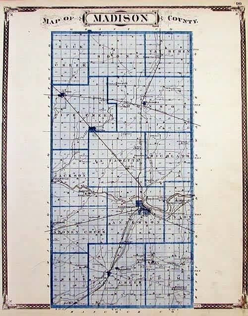
- Map of Madison County IN USA
- History
- Geography
- Adjacent counties
- Major highways
- Railroads
- Climate and weather
- Government
- Demographics
- References
Map of Madison County, IN, USA
Madison County is included in the Indianapolis-Carmel-Anderson, IN Metropolitan Statistical Area.
History
Madison County was formed in 1823. It was named for James Madison, co-author of The Federalist Papers and the fourth President of the United States (1809 to 1817).
Geography
According to the 2010 census, the county has a total area of 452.90 square miles (1,173.0 km2), of which 451.92 square miles (1,170.5 km2) (or 99.78%) is land and 0.99 square miles (2.6 km2) (or 0.22%) is water.
Adjacent counties
Major highways
Railroads
Climate and weather
In recent years, average temperatures in Anderson have ranged from a low of 18 °F (−8 °C) in January to a high of 84 °F (29 °C) in July, although a record low of −24 °F (−31 °C) was recorded in January 1985 and a record high of 105 °F (41 °C) was recorded in July 1954. Average monthly precipitation ranged from 2.09 inches (53 mm) in January to 4.28 inches (109 mm) in July.
Government
The county government is a constitutional body, and is granted specific powers by the Constitution of Indiana, and by the Indiana Code.
County Council: The county council is the legislative branch of the county government and controls all the spending and revenue collection in the county. Representatives are elected from county districts. The council members serve four-year terms. They are responsible for setting salaries, the annual budget, and special spending. The council also has limited authority to impose local taxes, in the form of an income and property tax that is subject to state level approval, excise taxes, and service taxes.
Board of Commissioners: The executive body of the county is made of a board of commissioners. The commissioners are elected county-wide, in staggered terms, and each serves a four-year term. One of the commissioners, typically the most senior, serves as president. The commissioners are charged with executing the acts legislated by the council, collecting revenue, and managing the day-to-day functions of the county government.
Court: The county maintains a small claims court that can handle some civil cases. The judge on the court is elected to a term of four years and must be a member of the Indiana Bar Association. The judge is assisted by a constable who is also elected to a four-year term. In some cases, court decisions can be appealed to the state level circuit court.
County Officials: The county has several other elected offices, including sheriff, coroner, auditor, treasurer, recorder, surveyor, and circuit court clerk Each of these elected officers serves a term of four years and oversees a different part of county government. Members elected to county government positions are required to declare party affiliations and to be residents of the county.
Madison County is part of Indiana's 5th congressional district; Indiana Senate districts 20, 25 and 26; and Indiana House of Representatives districts 35, 36 and 37.
Demographics
As of the 2010 United States Census, there were 131,636 people, 51,927 households, and 34,319 families residing in the county. The population density was 291.3 inhabitants per square mile (112.5/km2). There were 59,068 housing units at an average density of 130.7 per square mile (50.5/km2). The racial makeup of the county was 87.7% white, 8.3% black or African American, 0.4% Asian, 0.2% American Indian, 1.5% from other races, and 1.8% from two or more races. Those of Hispanic or Latino origin made up 3.2% of the population. In terms of ancestry, 21.5% were German, 12.5% were American, 11.5% were Irish, and 10.4% were English.
Of the 51,927 households, 31.3% had children under the age of 18 living with them, 47.4% were married couples living together, 13.6% had a female householder with no husband present, 33.9% were non-families, and 28.3% of all households were made up of individuals. The average household size was 2.41 and the average family size was 2.93. The median age was 39.2 years.
The median income for a household in the county was $47,697 and the median income for a family was $53,906. Males had a median income of $41,834 versus $31,743 for females. The per capita income for the county was $21,722. About 11.2% of families and 14.7% of the population were below the poverty line, including 22.6% of those under age 18 and 7.7% of those age 65 or over.