
Constructed 1 October 1926 | Length 245.9 km | |
 | ||
Existed: October 1, 1926 – present | ||
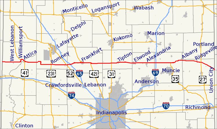
State Road 28 is an east–west road in central Indiana in the United States that crosses the entire state from east to west, covering a distance of about 153 miles (246 km) and passing about 20 miles (32 km) to the north of the state capitol of Indianapolis.
Contents
Map of IN-28, Indiana, USA
Route description
The western terminus of State Road 28 is at the Illinois state line where it continues the route of Illinois Route 119, about 7.5 miles (12.1 km) west of West Lebanon. The eastern terminus is at the Ohio state line where Ohio State Route 571 continues the route, near State Road 32 in the border-town of Union City. For most of its length it is an undivided two-lane road which mainly travels through flat, open farm land, avoiding the hillier and more wooded areas that begin not far to the south. It is divided for about 1 mile (1.6 km) just west of Frankfort, where it passes the Frankfort Municipal Airport.
State Road 28 has concurrencies with four U.S. routes, as well as four other Indiana state roads; these are described below.