
Constructed 1 October 1926 | Length 252.4 km | |
 | ||
Existed: October 1, 1926 – present Counties | ||
Westfield indiana state road 32 us 31
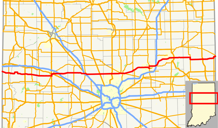
State Road 32 (SR 32) in the U.S. state of Indiana is an east–west state highway in central Indiana that crosses the entire state, covering a distance of about 157 miles (253 km). The western terminus of SR 32 is at the Illinois state line, southeast of Danville, Illinois, where the state highway becomes a county road. The eastern terminus is at Union City, Indiana, and Union City, Ohio, at the Ohio state border where the highway becomes Ohio State Route 47.
Contents
Map of IN-32, Indiana, USA
Route description
Between the Illinois state line and Crawfordsville, the highway runs somewhat parallel to Interstate 74. East of Crawfordsville, the highway is a popular alternate route for traffic from parts north and northeast of Indianapolis heading for westbound I-74.
Between I-65 and I-69, SR 32 travels through one of the highest-growth areas in the entire United States: Hamilton County, Indiana. Continuing east from I-69, SR 32 serves the towns of Anderson, Muncie, and Winchester.
The vast majority of SR 32 is rural and undivided. Portions of SR 32 between Muncie and Selma are divided.