
Country United States County Onondaga Area code(s) 315 Elevation 133 m Population 21,759 (2010) | State New York Time zone Eastern (EST) (UTC-5) FIPS code 36-44039 Zip code 13027 Local time Wednesday 2:01 PM | |
 | ||
Weather -7°C, Wind NW at 27 km/h, 79% Humidity | ||
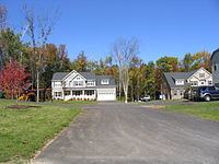
Lysander is a town in Onondaga County, New York, United States. The population was 21,759 at the 2010 census. The town was named after Lysander, a Spartan military leader, by a clerk interested in the classics. The town is in the northwest corner of Onondaga County and is northwest of Syracuse. Much of the town is a suburb of Syracuse.
Contents
Map of Lysander, NY, USA
History
The town was part of the former Central New York Military Tract. It was first settled by outsiders around 1797.
The Town of Lysander was formed in 1794 from the northern townships of the Military Tract. Lysander was later reduced by the creation of the Towns of Hannibal (1806) and Cicero (1807). Lysander was reduced again on the formation of Oswego County in 1816.
Geography
According to the United States Census Bureau, the town has a total area of 64.6 square miles (167 km2), of which, 61.9 square miles (160 km2) of it is land and 2.7 square miles (7.0 km2) of it (4.18%) is water.
The north town line is the border of Oswego County and the west town line is the border of Cayuga County. The south town line is defined by the Erie Canal-Seneca River complex. Cross Lake is located on the west border of Lysander. The Oswego River marks part of the east town line. The Oswego, Seneca, and Oneida Rivers join at the east town line.
New York State Route 370, West Genesee Road, is an east-west highway in the south part of Lysander. New York State Route 48 is a highway in the center of the town. New York State Route 31 intersects NY-370 in the southeast part of Lysander. New York State Route 690 is a major highway leading out of the south part of Lysander.
Demographics
As of the census of 2000, there were 19,285 people, 7,139 households, and 5,404 families residing in the town. The population density was 311.5 people per square mile (120.3/km²). There were 7,448 housing units at an average density of 120.3 per square mile (46.4/km²). The racial makeup of the town was 96.89% White, 0.73% African American, 0.29% Native American, 1.00% Asian, 0.02% Pacific Islander, 0.24% from other races, and 0.82% from two or more races. Hispanic or Latino of any race were 0.78% of the population.
There were 7,139 households out of which 39.8% had children under the age of 18 living with them, 64.5% were married couples living together, 7.9% had a female householder with no husband present, and 24.3% were non-families. 19.9% of all households were made up of individuals and 7.7% had someone living alone who was 65 years of age or older. The average household size was 2.70 and the average family size was 3.12.
In the town, the population was spread out with 28.8% under the age of 18, 5.5% from 18 to 24, 30.0% from 25 to 44, 25.4% from 45 to 64, and 10.3% who were 65 years of age or older. The median age was 38 years. For every 100 females there were 97.7 males. For every 100 females age 18 and over, there were 93.3 males.
The median income for a household in the town was $59,128, and the median income for a family was $67,539. Males had a median income of $47,057 versus $29,164 for females. The per capita income for the town was $26,187. About 2.5% of families and 3.8% of the population were below the poverty line, including 3.5% of those under age 18 and 5.2% of those age 65 or over.