
Width 0.18 km (0.112 mi) Population Uninhabited | Length 0.72 km (0.447 mi) Highest elevation 13 m (43 ft) Elevation 13 m | |
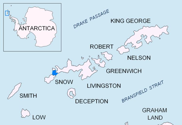 | ||
Long Rock is a large rock extending 720 m (787 yd) in east-west direction, 180 m (197 yd) wide and rising to 13 m (42.7 ft) in the northeast of Morton Strait in the South Shetland Islands, Antarctica. The area was visited by early 19th century sealers operating on Byers Peninsula.
Contents
Map of Long Rock, Antarctica
The feature was named by Discovery Investigations personnel that charted Morton Strait in 1930-31.
Location
The rock is located 1.6 km (0.99 mi) south-southwest of Vardim Rocks, 2.1 km (1.30 mi) south-southwest of Devils Point, 4.2 km (2.61 mi) north of President Head, Snow Island, 7 km (4.35 mi) east-northeast of Cape Timblón, Snow Island and 6.93 km (4.31 mi) southeast of Benson Point, Rugged Island (British mapping in 1933 and 1968, Argentine in 1946 and 1953, Chilean in 1947 and 1971, French in 1951, detailed Spanish mapping in 1992, and Bulgarian mapping in 2005 and 2009).