
Area 1,940 km² County seat Guthrie | Website www.logancountyok.com Founded 1890 Population 44,422 (2013) | |
 | ||
Points of interest Scottish Rite Temple, Oklahoma Territorial Museum, Oklahoma Frontier Drug Store, Oklahoma Sports Museum, Mulhall United Methodist | ||
Remembering coyle logan county oklahoma
Logan County is a county located in the U.S. state of Oklahoma. As of the 2010 census, the population was 41,848. Its county seat is Guthrie.
Contents
- Remembering coyle logan county oklahoma
- Map of Logan County OK USA
- History
- Geography
- Major highways
- Adjacent counties
- Demographics
- Politics
- Cities
- Towns
- Unincorporated communities
- Notable residents
- National Register of Historic Places
- Media
- References
Map of Logan County, OK, USA
Logan County is part of the Oklahoma City, OK Metropolitan Statistical Area. Guthrie served as the capital of Oklahoma Territory from 1890 until 1907 and of the state of Oklahoma from 1907 until 1910.
History
Logan County was created as County One by the Organic Act of 1890. The town of Guthrie was designated as the county seat and the capital of Oklahoma Territory. The county was named on August 5, 1890 for U. S. Senator, John A. Logan, of Illinois.
The land in what became Logan County had been settled during the 1820s and 1830s by the Creek and Seminole tribes after the forced Indian Removal by the federal government from their traditional historic territories in the American Southeast. These tribes supported the Confederate States of America during the Civil War, in part based on the CSA promise of an American Indian state if they won. The United States required the tribes that supported the Confederacy to make new Reconstruction Treaties in 1866.
As part of the treaties, the US reduced the lands of these tribes, designating certain areas as Unassigned Lands. This 2 million-acre area was reserved for years after the war as potential reservation lands for the Plains tribes, who were mostly settled in other areas. Congress passed a law in 1889, after the Indian Wars, to open the land to non-Indian settlement under terms of the 1862 Homestead Act. The land rush (or run) took place on April 22, 1889, whereby people rushed to establish homestead plots.
The three easternmost townships were added to the county in 1891, after areas of the Sac and Fox lands were also opened to non-Indian settlement, following allotment of communal lands to individual tribal households under implementation of the Dawes Act. This law resulted in massive losses of Indian land. The US classified lands remaining after allotment as "surplus" and allowed them to be sold to non-Natives.
Before 1889, the Kansas Southern Railway (later the Atchison, Topeka and Santa Fe Railway) had built a line from the Kansas-Oklahoma border to Purcell in Indian Territory. Stations built in the present Logan County were Beaver Creek (now Mulhall, Oklahoma) and Deer Creek (now Guthrie). After the land run, Guthrie, Oklahoma developed into a center of trade for the county and region, connected by railroads to other markets.
The Denver, Enid and Gulf Railroad (later the Atchison, Topeka and Santa Fe) ran from Guthrie to Enid, Oklahoma. The Choctaw, Oklahoma and Western Railroad (later the Chicago, Rock Island and Pacific Railway) ran between Guthrie and Chandler, Oklahoma, while the Missouri, Kansas and Texas Railroad ran east from Guthrie to Fallis, Oklahoma. From 1916 to 1944, the Oklahoma Railway Company interurban line ran between Guthrie and Oklahoma City.
Geography
According to the U.S. Census Bureau, the county has a total area of 749 square miles (1,940 km2), of which 744 square miles (1,930 km2) is land and 5.0 square miles (13 km2) (0.7%) is water. The county lies in the Red Bed Plains physiographic area. It is drained by the Cimarron River and the smaller streams Cottonwood Creek and Ephraim Creek.
Major highways
Adjacent counties
Demographics
As of the census of 2000, there were 33,924 people, 12,389 households, and 8,994 families residing in the county. The population density was 46 people per square mile (18/km²). There were 13,906 housing units at an average density of 19 per square mile (7/km²). The racial makeup of the county was 81.6% White, 11.0% Black or African American, 2.9% Native American, 0.3% Asian, 0.1% Pacific Islander, 1.2% from other races, and 2.9% from two or more races. 2.9% of the population was Hispanic or Latino of any race.
There were 12,389 households out of which 33.70% had children under the age of 18 living with them, 59.2% were married couples living together, 9.8% had a female householder with no husband present, and 27.4% were non-families. 23.7% of all households were made up of individuals and 9.7% had someone living alone who was 65 years of age or older. The average household size was 2.57 and the average family size was 3.04.
In the county, the population was spread out with 25.5% under the age of 18, 12.0% from 18 to 24, 26.5% from 25 to 44, 23.7% from 45 to 64, and 12.3% who were 65 years of age or older. The median age was 36 years. For every 100 females there were 97.60 males. For every 100 females age 18 and over, there were 92.90 males.
The median income for a household in the county was $36,784, and the median income for a family was $44,340. Males had a median income of $31,345 versus $22,677 for females. The per capita income for the county was $17,872. About 8.7% of families and 12.9% of the population were below the poverty line, including 15.0% of those under age 18 and 13.0% of those age 65 or over.
Politics
In Presidential politics, Logan County has been a reliable Republican county. Since 1960, it has only voted twice for the Democratic candidate, in 1964 for Lyndon B. Johnson) (53-47%) and last in 1976 when it narrowly went for Jimmy Carter (50-48%). Barack Obama barely received over 1/4th of the vote in 2012. This was a poorer showing than George McGovern's 29% performance in 1972.
In Gubernatorial politics, since 1990, it has voted 4 times for the Republican (1994, 1998, 2002 & 2010) and twice for the Democrat (1990, for David Walters and 2006 for Brad Henry's reelection.
In U.S. Senatorial politics, since 1990, it has also voted Republican in every contest with the exception of David Boren's reelection in 1990, when he carried every county in Oklahoma.
Cities
Towns
Unincorporated communities
Notable residents
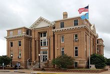
National Register of Historic Places
Sites listed on the National Register of Historic Places:
Media
Newspaper