
Founded 1893 Area 2,745 km² Unemployment rate 3.4% (Apr 2015) | Website www.garfieldok.com Population 62,267 (2013) | |
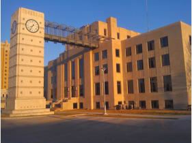 | ||
Colleges and Universities Phillips University, Autry Technology Center, Enid Beauty College Points of interest | ||
Remembering covington garfield county oklahoma
Garfield County is a county located in the U.S. state of Oklahoma. As of the 2010 census, the population was 60,580. Enid is the county seat and largest city within Garfield County. The county is named after President James A. Garfield.
Contents
- Remembering covington garfield county oklahoma
- Map of Garfield County OK USA
- Geography
- Adjacent counties
- Major highways
- Demographics
- Economy
- Cities
- Census designated place
- Other unincorporated places
- NRHP sites
- References
Map of Garfield County, OK, USA
Garfield County comprises the Enid, OK Metropolitan Statistical Area.
Prior to the Land Run of 1893, Garfield County was named O County and was part of the Cherokee Outlet, occupied by the Cherokee people following the Treaty of New Echota and the Cherokee trail of tears. Historically, the area was a hunting ground for the Wichita, Osage, and Kiowa tribes.
The Chisholm Trail, stage coach lines, mail routes, and railroads passed through stations at Buffalo Springs and Skeleton, today known as Bison and Enid. Railroad development in the county began four years prior to the land opening. Enid became a central hub within the county. Historical railroads included Enid and Tonkawa Railway, Enid and Anadarko Railway, Blackwell, Enid and Southwestern Railway, Enid Central Railway and the Denver, Enid and Gulf Railroad.
Geography
According to the U.S. Census Bureau, the county has a total area of 1,060 square miles (2,700 km2), of which 1,058 square miles (2,740 km2) is land and 1.6 square miles (4.1 km2) (0.2%) is water. Several creeks run through the county, including Black Bear, Boggy, Red Rock, Rock, Skeleton, and Turkey.
Adjacent counties
Major highways
Demographics
As of the census of 2000, there were 57,813 people, 23,175 households, and 15,805 families residing in the county. The population density was 55 people per square mile (21/km²). There were 26,047 housing units at an average density of 25 per square mile (10/km²). The racial makeup of the county was 88.65% White, 3.26% Black or African American, 2.11% Native American, 0.85% Asian, 0.49% Pacific Islander, 2.02% from other races, and 2.62% from two or more races. 4.13% of the population were Hispanic or Latino of any race.
There were 23,175 households out of which 31.40% had children under the age of 18 living with them, 54.20% were married couples living together, 10.50% had a female householder with no husband present, and 31.80% were non-families. 27.70% of all households were made up of individuals and 12.10% had someone living alone who was 65 years of age or older. The average household size was 2.42 and the average family size was 2.95.
In the county, the population was spread out with 25.00% under the age of 18, 9.10% from 18 to 24, 27.30% from 25 to 44, 22.50% from 45 to 64, and 16.00% who were 65 years of age or older. The median age was 38 years. For every 100 females there were 93.70 males. For every 100 females age 18 and over, there were 90.40 males.
The median income for a household in the county was $33,006, and the median income for a family was $39,872. Males had a median income of $29,921 versus $20,791 for females. The per capita income for the county was $17,457. About 10.50% of families and 13.90% of the population were below the poverty line, including 19.70% of those under age 18 and 10.40% of those age 65 or over.
Economy
Primary industries in Garfield County are agriculture and livestock. Historically, crops have included wheat, corn, oats, sorghum, Kaffir corn, and alfalfa. In addition, oil and gas and flour milling have proved fruitful for the county. The county seat of Enid, Oklahoma has the most grain storage capacity in the United States and one of the largest grain elevators in the world. Vance Air Force Base is also a major employer in the area of both soldiers and civilians.
Cities
Census-designated place
Other unincorporated places
NRHP sites
The following sites in Garfield County are listed on the National Register of Historic Places: